Categoria: EN

  • Where to sleep in Naples: Info and Tips

    Where to sleep in Naples: Info and Tips

    Napoli, vista panoramica di notte

    Where to sleep in Naples: Info and Tips

    Quick Guide to Neighborhoods and Accommodation Options


    Staying in Naples is convenient thanks to the variety of easily accessible neighborhoods and the close proximity to the city’s main attractions.


    Naples can be explored comfortably thanks to its wide range of public transportation options and the compact layout of the historic center (see also Getting around Naples 🔗). Choosing carefully where to stay is essential to optimize travel time and fully enjoy its history, landmarks, and traditional cuisine.

    The historic center is the ideal choice for those who want to explore monuments, museums, churches, and typical restaurants on foot, with strategic areas such as Spaccanapoli, Chiaia, and Vomero. Other interesting districts include Santa Lucia and Porto, overlooking the sea, Posillipo, elegant and panoramic, as well as Piazza del Plebiscito and Mercato, perfect for experiencing the city’s most authentic atmosphere.

    Each neighborhood has its own character, making Naples a city full of contrasts and surprises, perfect for both short stays and longer vacations.


    Historic Center – Spaccanapoli
    The Spaccanapoli district is the beating heart of Naples, with historic churches, squares, and characteristic alleys. Staying here means immersing yourself in Neapolitan culture and having the main attractions within easy reach.

    • Indicative price range: €70 – €250/night (hotels, B&Bs, and boutique stays)
    • Recommended for: couples, cultural tourists, families
    • Practical notes: mostly pedestrian area, perfect for exploring on foot.

    Chiaia – Seafront
    The Chiaia area is elegant and central, ideal for those who enjoy walking along the seafront, shopping, and dining at refined restaurants. Great for comfortable stays near the city center.

    • Indicative price range: €100 – €350/night (mid to high-range hotels, boutique stays)
    • Recommended for: couples, demanding travelers, romantic stays
    • Practical notes: elegant area, well-served by buses, parking available.

    Vomero
    The Vomero district, located on the panoramic hill, offers spectacular views of the city and the Gulf of Naples. Ideal for those seeking tranquility without giving up connections to the center.

    • Indicative price range: €80 – €220/night (hotels, B&Bs, apartments)
    • Recommended for: families, couples, travelers seeking relaxation
    • Practical notes: excellent connections via funiculars and metro, quiet area.

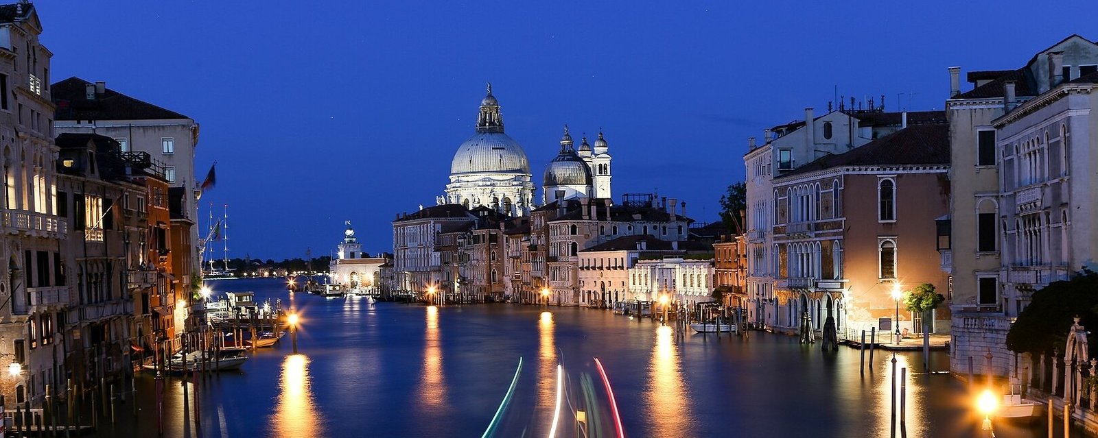
    Santa Lucia – Seafront
    The Santa Lucia area is ideal for those who want to enjoy the seafront and views of Castel dell’Ovo. Perfect for romantic stays or for those who love being close to the sea and scenic walks.

    • Indicative price range: €90 – €280/night (hotels, boutique stays, B&Bs)
    • Recommended for: couples, travelers seeking views and romantic atmosphere
    • Practical notes: quiet area, close to the sea, limited parking available.
    Prenota con Booking.com

    Tourplan recommends Booking.com to book hotels, B&Bs and apartments

    Port of Naples – Molo Beverello and Municipio
    The Port of Naples area (see more info🔗), between Molo Beverello, Municipio and the areas adjacent to the Historic Center, is ideal for those who need to embark early or arrive in the city late at night.

    • Indicative price range: €70 – €220/night (business hotels, B&Bs, guesthouses)
    • Recommended for: travelers in transit, cruise passengers, business travelers
    • Practical notes: central location, excellent connections to metro and port.

    Posillipo
    Posillipo is an exclusive residential area with villas and panoramic apartments. Ideal for those seeking tranquility and privacy, away from the city center bustle but well connected.

    • Indicative price range: €120 – €400/night (boutique hotels and luxury apartments)
    • Recommended for: couples, families seeking relaxation
    • Practical notes: panoramic area, less frequent public transport.

    Piazza del Plebiscito
    Piazza del Plebiscito is the monumental heart of the city, surrounded by theaters, historic cafés, and institutional buildings. Perfect for experiencing Naples also in the evening.

    • Indicative price range: €80 – €250/night (hotels and B&Bs)
    • Recommended for: cultural tourists, couples, business travelers
    • Practical notes: central area, limited parking, excellent connections.

    Capodichino Airport Area
    Accommodation near Naples Capodichino Airport (see more info🔗) is ideal for early departures or late arrivals.

    • Indicative price range: €60 – €150/night (budget hotels and B&Bs)
    • Recommended for: travelers in transit, business express
    • Practical notes: quick connections via taxis and shuttles.

    The best time to book accommodation in Naples depends on the season and the type of experience you want to have:

    • High season: spring (April-June) and early autumn (September-October) are ideal for visiting Naples, thanks to mild weather and cultural events. Prices rise during these months, and booking 2-3 months in advance is recommended.
    • Low season: from November to February, excluding holidays, you can find lower rates and fewer crowds, perfect for those who want to explore the city at a relaxed pace and save money.
    • Summer: July and August can be hot and crowded, especially along the waterfront and in central areas, but offer good opportunities for longer stays or last-minute bookings.

    Events, holidays, and special periods

    Naples hosts numerous events, religious holidays, and cultural festivals that can influence accommodation availability and prices:

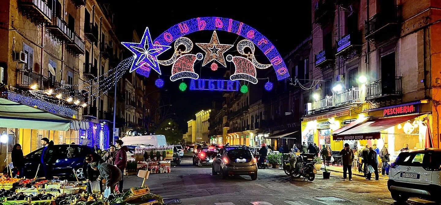
    • Christmas holidays and the nativity scene period (December), especially in the historic center and San Gregorio Armeno
    • Easter and other religious holidays, attracting large numbers of visitors
    • Cultural and musical events at Teatro San Carlo or along the waterfront
    • Sporting events and major matches, which may affect availability in central areas

    During these periods, especially in high-demand areas such as the historic center, Chiaia, and the waterfront, it is advisable to book well in advance.

    Cancellation policies

    Before confirming a reservation in Naples, it is always useful to carefully check the conditions offered by the property:

    During high season or special events, policies may be stricter: always read the terms before booking.

    Whenever possible, choose properties with free cancellation or flexible rates, ideal in case of changes in plans.

    Check the deadlines for penalty-free cancellation and any restrictions on changing dates or the number of guests.


    Which area is best to stay in Naples?

    The historic center is ideal for a first visit, while Chiaia and Vomero offer more tranquility and comfort.

    Is Naples convenient if staying outside the center?

    Yes, thanks to the metro, funiculars, and buses, even the hill areas are well connected.

    📌 See details in the paragraph Overview.


    Which are the best neighborhoods to stay in Naples?

    Spaccanapoli, Chiaia, Vomero, Santa Lucia, and Posillipo are among the most popular areas.

    Where to stay in Naples on a budget?

    Vomero, Porto, and the Capodichino area offer more economical and well-connected options.

    📌 See details in the paragraph Best Areas.


    When is the best time to book accommodation in Naples?

    Spring and autumn require early bookings, while in winter there are more offers available.

    Do events and holidays affect prices?

    Yes, periods like Christmas, Easter, and sports events can increase prices and demand.

    📌 See details in the paragraph Seasons, Events & Other.

  • Where to sleep in Florence: Info and Tips

    Where to sleep in Florence: Info and Tips

    Firenze, vista panoramica della città illuminata di notte, da Piazzale Michelangelo

    Where to sleep in Florence: Info and Tips

    Quick Guide to Neighborhoods and Accommodation Options


    Staying in Florence is convenient thanks to the compactness of the historic center and the proximity to the main attractions. In this guide, you will discover the best neighborhoods to stay in to plan your visit efficiently.

    See also:


    Florence can be comfortably explored on foot thanks to the numerous pedestrian areas and the ZTL that limits traffic in the historic center (see also Getting around Florence 🔗). Choosing where to stay carefully is essential to optimize your time and get the most out of its wonders.

    The historic center is the ideal area for those who want monuments, museums, shops, and restaurants within easy reach. The strategic neighborhoods within it are: San Giovanni, the historic heart with the Duomo and Piazza della Signoria, perfect for a short visit; Santa Maria Novella, close to the train station and convenient for quick transfers; Santa Croce, full of artisan workshops and typical local venues; Santo Spirito and San Niccolò, ideal for those seeking authentic atmospheres or nightlife; and the Oltrarno, on the south bank of the Arno, offering quieter accommodations immersed in local life, perfect for a relaxed stay.

    Each neighborhood has unique characteristics that make Florence a harmonious and charming city, perfect for both a short stay and a longer vacation.


    Historic Center – San Giovanni

    The San Giovanni neighborhood is the vibrant heart of Florence, with the Duomo, Piazza della Signoria, and main cultural attractions within reach. Staying here means immersing yourself in Florentine history and culture, ideal for those with limited time who want to maximize their visit.

    • Price range: €120 – €400/night (mid to high-end hotels, boutique hotels)
    • Recommended for: families, couples, cultural tourists, romantics
    • Practical notes: pedestrian area, limited parking, perfect for visiting main attractions on foot

    Santa Maria Novella – Train Station

    The area around Santa Maria Novella Station is strategic for train arrivals or frequent travelers. Numerous hotels, B&Bs, and apartments are available, functional and close to the historic center.

    • Price range: €80 – €250/night (mid-range hotels and B&Bs)
    • Recommended for: business travelers, train tourists, those seeking convenience
    • Practical notes: convenient for train and bus connections, limited but accessible parking

    Santa Croce

    The Santa Croce neighborhood, east of the historic center, is full of artisan workshops, cafés, and typical restaurants. Perfect for those seeking an authentic experience without straying too far from the main attractions.

    • Price range: €90 – €250/night (B&Bs and boutique hotels)
    • Recommended for: couples, young travelers, those seeking an authentic or immersive cultural experience
    • Practical notes: mostly pedestrian area, close to restaurants and typical venues

    Santo Spirito – San Niccolò

    Located in the Oltrarno, the Santo Spirito and San Niccolò neighborhoods offer different experiences: Santo Spirito is known for nightlife and evening venues, while San Niccolò is quieter, ideal for families or those seeking a relaxed stay.

    • Price range: €70 – €220/night (B&Bs, apartments, hostels)
    • Recommended for: young travelers, couples, families, lovers of nightlife or tranquility
    • Practical notes: lively or quiet area depending on the neighborhood, limited parking

    Prenota con Booking.com

    Tourplan recommends Booking.com to book hotels, B&Bs and apartments

    Oltrarno

    The Oltrarno is perfect for living Florence like a local, among artisan workshops, small restaurants, and charming streets. Apartments and residences are also available here, ideal for longer stays.

    • Price range: €80 – €300/night (apartments, boutique hotels, hotels)
    • Recommended for: families, long stays, those seeking authenticity
    • Practical notes: limited parking, quiet area, bus connections

    Campo di Marte / Artemio Franchi Stadium

    The Campo di Marte area is suitable for those looking for more affordable accommodations or longer stays, away from the city center bustle but well-connected to main points of interest.

    • Price range: €60 – €150/night (budget hotels, B&Bs)
    • Recommended for: families, budget travelers, sports fans attending stadium events
    • Practical notes: convenient bus and tram connections, available parking, more residential and quiet than the center

    Rifredi – Careggi

    The Rifredi – Careggi district is a well-connected residential area, thanks to the tram line and regional trains. It is a practical choice for travelers arriving by car, looking for more affordable accommodation or planning medium- to long-term stays, without giving up convenient access to the city center.

    • Indicative price range: €60 – €180/night (budget hotels, B&Bs, apartments)
    • Recommended for: families, budget travelers, long stays, travelers by car
    • Practical notes: fast connections by tram and train, easier parking than in the historic center

    Florence Peretola Airport

    For those arriving by plane, accommodation near Florence Peretola Airport (see detailed guide🔗) offers convenience and quick transfers to the city center.

    • Price range: €60 – €150/night (budget hotels and B&Bs)
    • Recommended for: transit travelers, air arrivals, express business trips
    • Practical notes: great for early departures or late arrivals, fast connections to the center via shuttle or taxi

    When to book

    The right time to book depends on the season and the type of trip:

    • High season: spring (April–June) and autumn (September–October) are the most popular periods to visit Florence. Prices increase, so it is recommended to book at least 2–3 months in advance.
    • Low season: November–February offers more affordable rates and fewer crowds, ideal for those seeking peace and savings.

    Events and trade fairs

    Florence hosts numerous events, festivals, and trade fairs that can affect accommodation availability and prices:

    • Firenze Rocks or summer music events
    • Pitti Uomo (fashion, January and June)
    • Major temporary exhibitions in museums such as the Uffizi or Palazzo Pitti
      During these dates, prices may double and the best accommodations should be booked well in advance.

    Cancellation policies

    When booking a hotel, B&B, or apartment, pay close attention to the cancellation conditions:

    Always check the deadlines for free cancellation and any additional costs for date changes or changes in the number of guests.

    Choose properties with flexible rates, allowing you to change or cancel your stay without penalties in case of unforeseen events.


    What is the best area to stay in Florence?

    The historic center is ideal for a first visit, while Oltrarno and Santo Spirito offer a more authentic and relaxed experience.

    Is Florence convenient if you stay outside the city center?

    Yes, the city is compact and well connected. Even slightly peripheral areas allow quick and easy travel.

    📌 Learn more in the Overview section.


    Which are the best neighborhoods to stay in?

    San Giovanni, Santa Maria Novella, Santa Croce, Oltrarno, and Campo di Marte are among the most popular areas for travelers.

    Where to stay in Florence on a budget?

    Campo di Marte and the area near Florence Peretola Airport offer more affordable prices and good transport connections.

    📌 Learn more in the Best Areas section.


    When is the best time to book accommodation in Florence?

    In spring and autumn it is best to book in advance. In winter, you can find better deals.

    Do events affect hotel prices?

    Yes, events such as Pitti Uomo or major concerts can increase prices and reduce availability.

    📌 Learn more in the Seasons, Events & Other section.

  • BASE DOVE DORMIRE – EN

    BASE DOVE DORMIRE – EN

    Dove dormire EN

    Quick Guide to Neighborhoods and Accommodation Options


    Prenota con Booking.com

    Tourplan recommends Booking.com to book hotels, B&Bs and apartments


  • Getting around Venice: Info and Tips

    Getting around Venice: Info and Tips

    Venezia, Canal Grande alla sera visto dal Ponte dell'Accademia

    Getting around Venice: Info and Tips

    Quick Guide to Getting Around the City


    Venice is a unique city in the world, characterized by canals, alleys, and bridges, where getting around may seem complicated at first glance. In reality, once you understand the main modes of transport, moving around Venice becomes simple and efficient.


    Getting around Venice requires some planning, given the city’s unique layout across canals and islands. The city combines the historic center on the main island, with alleys and bridges, and several smaller islands, each accessible via specific transport options.

    In the historic center, where many major landmarks and points of interest such as St. Mark’s Square, the Rialto Bridge, and the Grand Canal are located, walking is often the best way to get around: distances are short, and walking allows you to fully experience the city’s unique atmosphere, avoiding queues and the crowds on public transport.

    To cover longer distances or reach islands like Murano, Burano, and Lido, Venice offers an efficient and scenic public transport network, based on vaporetti and ferries. These connect the main attractions, train stations, and tourist ports effectively.

    Using a private car is practically impossible in the historic center and generally not recommended even on the mainland areas such as Mestre, due to access restrictions and limited parking.

    A helpful support for first-time visitors to Venice can be a guided walking tour or a vaporetto tour, useful to understand the structure of the districts, navigate canals and bridges, and gain practical references for subsequent movements (see more info🔗).

    Finally, in recent years alternative mobility solutions have grown, such as shared water taxis, private gondolas for short trips, or bike rental services on Lido Island. Their use should be carefully planned, considering the traffic on main canals and tourist seasonality.


    Venice is connected nationally and internationally thanks to an extensive network of air, rail, road, and sea links. The city develops on an archipelago of islands, making an organized arrival essential to move easily between the historic center, the mainland, and the smaller islands.

    By plane

    Venice-Tessera Airport (see more info 🔗) is served by numerous domestic and international flights, including low-cost connections. From the airport, the city center can be reached via shuttle buses, vaporetti, water taxis, private transfers, or rental cars, with average travel times of 20–40 minutes depending on the destination.

    ✅ To search or book flights to/from Venice you can use Booking.com Flights.

    By train

    Venezia Santa Lucia is the city’s main train station, located on the Grand Canal and connected to all major Italian cities via high-speed, Intercity, and regional trains. From the station, you can quickly reach the historic center, St. Mark’s Square, and main districts using vaporetti, water taxis, or on foot. Those arriving in Mestre can use local buses and trains to reach Venice.

    ✅ You can check routes, schedules, prices, and buy tickets with Trainline.

    By car

    Venice is connected to the main Italian highways via the A4 and SS309 “Romea”. Those arriving by car should consider that access to the historic center is prohibited for private vehicles: it is advisable to park at Piazzale Roma or Tronchetto and continue with vaporetti, water taxis, or on foot.

    ✅ For car rentals you can refer to Booking.com Cars.

    By bus

    Venice is connected to many Italian and European cities via long-distance buses, with main stops in Mestre and Tronchetto. Services are integrated with the urban bus network and vaporetti, making transfers to the historic center and main attractions easy.

    ✅ You can check routes, schedules, and buy tickets with Trainline.

    By taxi or private transfer

    Water taxis and private transfer services allow you to reach Venice from airports, train stations, or nearby cities directly and comfortably. Travel times vary depending on the departure point and canal conditions, offering a convenient option for those who prefer direct transfers.

    By ship

    Those arriving by sea can use the Port of Venice (see more info🔗), located near Tronchetto and Piazzale Roma. The port is connected to the historic center via vaporetti, water taxis, and private transfer services, with average travel times of 10–30 minutes depending on the destination.

    ✅ You can check schedules, companies, and available sea connections via DirectFerries.


    Walking is one of the best ways to explore Venice, especially within the historic center, where the main monuments, squares and bridges are located relatively close to one another.

    Historic center and districts

    The historic center of Venice is ideal for walking: areas such as St Mark’s Square, Rialto Bridge, Campo Santa Margherita, Cannaregio and Dorsoduro are easily connected by short walks. Distances between points of interest are often shorter than they appear on the map, though bridges and winding routes should be taken into account.

    Distances and walking times

    Many routes in the historic center require limited walking time: for example, from St Mark’s Square to the Rialto Bridge it takes about 5–10 minutes on foot, while from Campo Santa Margherita to Dorsoduro the walk lasts around 15–20 minutes. Longer routes, such as from Piazzale Roma to St Mark’s Square, take approximately 20–30 minutes.

    Road surface and comfort

    Venice features varied ground surfaces, including cobblestones, stone slabs and historic paving, especially on bridges and in narrow calli. Wearing comfortable shoes suitable for long walks and steps is strongly recommended, avoiding stiff footwear or thin soles.

    Bridges and crossings

    When walking, it is important to consider the many bridges connecting districts and islands: some have steep steps and longer routes than suggested by maps. Planning short breaks and following recommended pedestrian paths can make the experience easier.

    Safety and liveability

    Venice is generally a safe city to explore on foot, especially in central and tourist areas. As in any city, it is advisable to stay alert in the evening hours and in crowded zones such as St Mark’s Square or major bridges, where crowds can be intense.

    Urban experience

    Walking through Venice means experiencing the city authentically: narrow calli, hidden campos, historic bridges, monumental squares and artisan workshops turn every journey into an integral part of the travel experience, transforming simple routes into continuous discoveries.


    Public transport in Venice allows you to move between the historic center, the mainland and the smaller islands, covering a truly unique city. The public transport system includes water buses (vaporetti), urban buses, the Mestre tram line and island connections, offering solutions suitable for both short and medium-to-long journeys.

    Vaporetti

    Vaporetti are the main form of public transport in Venice. They operate along the Grand Canal, connect the main districts and reach islands such as Murano, Burano and the Lido. Routes are numbered and serve both major tourist paths and more local connections. Vaporetti are useful for avoiding long walking routes or multiple bridges.

    Urban buses

    In Mestre and on the mainland, the urban bus network connects the historic center with the railway station, the airport and nearby destinations. Buses are essential for those staying outside the historic center who need quick access to Piazzale Roma or Tronchetto.

    Tram and integrated lines

    The Mestre tram line provides fast connections between Mestre, the city center and the railway station, integrating with buses and vaporetti. Integrated lines offer a reliable and efficient alternative for travel on the mainland.

    Water taxis

    Water taxis provide direct and private transfers between the historic center, stations, airports and nearby islands. They are especially convenient for travelers with luggage or groups, but fares are higher than vaporetti.

    Gondolas and alternative services

    Gondolas and other private services are more of a tourist experience than a practical transport option, ideal for short scenic rides or panoramic tours. They are not suitable for fast or everyday travel, but they enhance the urban experience.

    Tickets and passes

    The fare system includes single tickets, daily passes and travel cards valid on vaporetti, urban buses and the tram line. Cost-effective options are available for multi-day stays or island hopping. For updated information on fares, timetables and routes, it is recommended to consult the official ACTV website.

    When to use public transport

    Public transport is especially useful for quickly reaching the islands, travelling along the Grand Canal or moving between more distant districts. In the historic center, particularly between St Mark’s Square and Rialto, walking often remains the most practical and atmospheric option.


    Driving a car in Venice can be convenient for arrivals, departures or travel to the mainland and minor islands, but it requires attention, especially due to the presence of Limited Traffic Zones (ZTL), numerous access points, heavy traffic and limited parking in the historic city.

    Limited Traffic Zone (ZTL)

    The historic center of Venice is entirely pedestrian: car access is allowed only to residents and authorized vehicles. Electronic gates and access points regulate entry, making it necessary to leave the car in interchange areas such as Piazzale Roma or Tronchetto. Before entering, it is essential to check permits and access times.

    Parking areas and interchange points

    Venice offers parking facilities at Piazzale Roma, Tronchetto and private garages, ideal for leaving your car and continuing on foot, by vaporetto or by water taxi. Blue lines indicate paid parking, while paid parking areas inside garages provide guaranteed spaces, often with daily rates. Parking facilities are also available in Mestre, connected to the historic center by bus or tram.

    Traffic and practical tips

    Traffic on the mainland can be heavy, especially during peak hours towards Mestre or Piazzale Roma. It is advisable to plan journeys in advance and consider using park-and-ride facilities to avoid stress and long waits.

    When it is convenient to use a car

    Using a car is mainly recommended for those arriving from other cities, heading to Mestre or nearby areas, or transporting luggage or planning trips to nearby destinations such as Padua, Treviso or the Lido. For getting around Venice’s historic center, vaporetti, water taxis and walking remain the most effective choices.

    ✅ For more options and online bookings, you can check the ParkingMyCar service, which allows you to find parking throughout the city.


    What is the best way to get around Venice?

    The best option is to walk in the historic center and use vaporetti or water taxis for longer routes and islands.

    Is Venice difficult for first-time visitors?

    At first it may seem confusing, but once you learn the main canals and routes, moving around is easy.

    📌 Learn more in the Overview section.


    How do you get to Venice from the airport?

    From Marco Polo or Treviso Airport you can reach Venice by shuttle bus, water taxi, vaporetto, or car to parking areas.

    Can you arrive in Venice by train or ship?

    Yes. Venice Santa Lucia station serves national trains, while the Port of Venice handles ferries and cruise ships.

    📌 Learn more in the Getting There section.


    What is the fastest public transport in Venice?

    Vaporetti and water taxis are the fastest options for islands and long routes. Walking is best for short distances.

    Are transport passes available?

    Yes. Daily and multi-day passes are valid on ACTV vaporetti and public transport lines.

    📌 Learn more in the Public Transport section.


    Is using a car in Venice recommended?

    Only for reaching the mainland or parking areas. Cars are not allowed in the historic center.

    Where should you park when visiting Venice?

    Park at Piazzale Roma, Tronchetto, or Mestre. These areas connect easily to Venice by public transport.

    📌 Learn more in the Getting Around by Car section.

  • Getting around Perugia: Info and Tips

    Getting around Perugia: Info and Tips

    Perugia, scorcio città vecchia

    Getting around Perugia: Info and Tips

    Quick Guide to Getting Around the City


    Perugia is a hilltop city with a compact medieval historic center and a more extensive modern area. Getting around may seem challenging at first, especially due to the slopes and different urban levels, but thanks to escalators, the minimetro, and well-integrated public transport, moving around Perugia is easier and more efficient than one might expect.


    Getting around Perugia requires a bit of initial orientation, especially due to its hilly layout and the clear distinction between the historic center and modern neighborhoods. The city develops on multiple levels, combining compact medieval areas with more recent, flat zones connected by integrated transport systems.

    In the historic center, largely enclosed within Etruscan and medieval walls, walking is often the best option. Distances are short and allow easy access to main points of interest, although the presence of slopes and staircases makes it advisable to move at a relaxed pace.

    To connect the center with outer areas, Perugia has an efficient network of public transport, consisting of urban buses and the Minimetrò, particularly useful for overcoming elevation differences and quickly reaching areas like Pian di Massiano, home to strategic parking lots.

    A distinctive feature of mobility in Perugia is the system of escalators and urban elevators, which allows visitors to ascend from parking areas and stations to the heart of the historic city, significantly reducing effort and travel time.

    The use of a private car is generally not recommended within the historic center, both because of narrow streets and the presence of a Limited Traffic Zone (ZTL). It is preferable to leave the car in exchange parking lots and continue with public transport or mechanized routes.

    For a first visit, participating in a guided walking tour or following recommended routes can be helpful to understand the urban layout, navigate the city’s different levels, and acquire practical references for moving independently in the following days.

    Finally, alternative mobility solutions such as bicycles and electric scooters are available, better suited to flat and peripheral areas. In the historic center, their use is limited due to slopes and uneven pavement.


    Powered by GetYourGuide

    Perugia is well connected both nationally and internationally, thanks to a network of air, rail, and road links. Its central position in Umbria makes it easily reachable from many Italian cities, making it accessible for both tourism and business travel.

    By Air

    The Umbria International Airport – Perugia San Francesco d’Assisi (also called Perugia Sant’Egidio, see Info & Tips 🔗) serves national and international flights, especially low-cost and seasonal connections. From the airport, the city center can be reached by bus, taxi, rental car, or private transfer, with an average travel time of 20–30 minutes.

    ✅ To search or book a flight to/from Perugia, you can check Booking.com Flights.

    By Train

    Perugia Fontivegge is the main railway station in the city and is connected to Rome, Florence, and major Umbrian towns via regional and Intercity trains. The station is linked to the historic center via the Minimetrò, urban buses, and taxis, allowing fast access to central areas.

    ✅ You can check routes, schedules, prices, and buy tickets on Trainline.

    By Car

    Perugia is easily reachable by car via the E45 and SS75, connecting it with central and northern Italy. Those arriving by car should consider the Limited Traffic Zone (ZTL) in the historic center. It is recommended to use park-and-ride facilities at the city’s edges and continue with escalators, the Minimetrò, or public transport.

    ✅ For car rental, you can refer to Booking.com Cars.

    By Bus

    Perugia is connected to numerous Italian cities by long-distance buses, mainly arriving at Piazza Partigiani and the Fontivegge station. From there, it is easy to continue to the historic center and main neighborhoods via the urban bus network and the Minimetrò.

    ✅ You can check routes, schedules, and buy tickets on Trainline.

    By Taxi or Private Transfer

    Taxis and private transfer services allow direct and comfortable travel to Perugia from the airport, railway stations, or nearby cities. This is a practical solution for travelers with luggage or those who prefer to avoid changing transport modes.


    Walking is one of the best ways to explore Perugia, especially within the historic center, where most attractions are concentrated in a relatively compact area.

    Historic Center and Neighborhoods

    The historic center of Perugia stretches along the hill ridge and is ideal to visit on foot: areas such as Corso Vannucci, Piazza IV Novembre, Fontana Maggiore, San Lorenzo Cathedral, and Rocca Paolina are easily reachable with short walks.

    Distances and Travel Times

    Distances in the historic center are generally short: from Piazza IV Novembre to Corso Vannucci takes just a few minutes on foot, while reaching Rocca Paolina or the main museums requires short but sometimes steep walks. Travel times depend more on elevation changes than on distance.

    Elevation and Slopes

    Perugia is characterized by ups and downs and staircases, typical of hill towns. This makes the visit scenic but requires some physical preparation. Proceeding slowly and alternating walking with mechanized sections is often the best solution.

    Escalators and Assisted Paths

    A major advantage for pedestrians is the efficient system of escalators and urban elevators, connecting parking areas and lower city zones to the historic center. These paths help overcome elevation changes, greatly reducing effort.

    Road Surface and Comfort

    The road surfaces in the historic center are mostly stone, cobblestones, and historic pavements. Comfortable walking shoes suitable for uneven and sloping surfaces are therefore recommended.

    Traffic and Walkability

    Vehicle traffic is limited in the historic center by the ZTL, making central areas particularly pleasant to explore on foot. It is still important to pay attention in access zones and along streets connecting to outer neighborhoods.

    Urban Experience and Panoramas

    Walking through Perugia means immersing yourself in an authentic atmosphere: medieval alleys, arches, panoramic terraces, and views over the Umbrian countryside make every walk a continuous discovery experience, making the city ideal to be explored step by step.


    Perugia’s public transport allows travel between the historic center, residential neighborhoods, and outskirts, providing effective solutions despite the city’s hilly layout. The system mainly consists of urban buses, Minimetrò, and integrated services, designed to overcome elevation changes and reduce private car use.

    Urban Buses

    The urban bus network connects the historic center with outer neighborhoods, train stations, the airport, and main residential areas. The lines are numerous and widespread, although traffic can cause delays during peak hours. Buses are the most common means for daily city travel.

    Minimetrò

    The Perugia Minimetrò is one of the most practical and distinctive transport systems in the city. It connects Pian di Massiano, an area with large parking lots, to the historic center, with strategic intermediate stops. It is especially useful for overcoming elevation and quickly reaching the city center without traffic.

    Escalators and Mechanized Paths

    A distinctive feature of Perugia mobility is the system of escalators, elevators, and mechanized paths, connecting parking lots, stations, and lower areas with the historic center. These routes are integrated with buses and the Minimetrò, making pedestrian travel easier.

    Taxi

    Taxis are available at Perugia Fontivegge station, the airport, main squares, and central areas. They provide a convenient option for direct trips, especially for travelers with luggage or during evening hours when public transport is less frequent.

    Tickets and Passes

    The fare system includes single tickets, daily passes, and subscriptions valid on buses and the Minimetrò (see official site). Fares are integrated, allowing combined use of different transport modes. For updated information on schedules, lines, and prices, consult the Umbrian local public transport website (see official site).

    When to Use Public Transport

    Public transport is particularly useful for reaching the historic center from park-and-ride lots, moving between outer neighborhoods, and covering uphill distances. Within the historic center, walking is often the most practical option, optionally combined with escalators and assisted paths.


    Driving in Perugia can be useful for arrivals, departures, or reaching peripheral areas, but it requires attention due to the city’s hilly layout and the presence of a Limited Traffic Zone (ZTL) in the historic center.

    Limited Traffic Zone (ZTL)

    The historic center of Perugia is regulated by a ZTL active during specific hours, with access reserved for residents and authorized vehicles. Electronic gates control entry, and fines are frequent. Before entering, it is essential to check schedules, activation days, and available permits.

    Pedestrian areas and historic center

    Many areas of the historic center, particularly along Corso Vannucci and around Piazza IV Novembre and the Fontana Maggiore, are pedestrian or have heavily restricted access. In these cases, it is recommended to park outside the city walls and continue on foot or by public transport.

    Traffic and road conditions

    Traffic in Perugia is generally lower than in large cities, but it can increase during peak hours, events, fairs, or demonstrations. Access roads to the center often feature steep inclines, curves, and narrow lanes, making driving more challenging.

    Parking areas

    Perugia has on-street parking, paid lots, and numerous multi-story car parks, often connected to the historic center via escalators or the Minimetrò. Park-and-ride lots, such as Pian di Massiano, are a practical solution to leave your car and reach the center without stress.

    🅿️ Pian di Massiano Parking

    For those arriving in Perugia by car, the best option is the Pian di Massiano Car Park (see map 🔗). This large parking lot is located at the foot of the historic center, easily accessible from main roads, and ideal for stress-free parking.

    The lot has 1200 parking spaces and is designed as a strategic access point to the city. From here, the Minimetrò departs (see Pian di Massiano terminal 🔗), allowing you to reach the historic center in minutes, avoiding traffic, ZTL, and steep inclines.

    When to use a car

    Driving is recommended mainly for reaching peripheral neighborhoods, accommodations outside the center, or excursions in the surrounding Umbrian area. To visit the historic center, it is usually more effective to combine external parking, mechanized paths, and walking.

    ✅ For more options and online bookings, you can check the ParkingMyCar service, which allows you to find parking throughout the city.


    What is the best way to get around Perugia?

    The ideal solution is to park outside the center and move around on foot or using the MiniMetrò.

    Is Perugia easy to explore?

    Yes, the historic center is compact and well connected by public transport systems.

    📌 Learn more in the Overview section.


    How can you reach Perugia?

    Perugia can be reached by car, train, and bus from the main cities of Umbria and Central Italy.

    Is the train station connected to the historic center?

    Yes, thanks to urban buses and the MiniMetrò.

    📌 Learn more in the Getting There section.


    What is the most convenient public transport in Perugia?

    The MiniMetrò is the fastest and most practical way to reach the historic center.

    Are urban buses useful for tourists?

    Yes, they cover neighborhoods well and complement the MiniMetrò service.

    📌 Learn more in the Public Transport section.


    Is it worth using a car in Perugia?

    It is useful for arriving in the city, but not recommended in the historic center.

    Where is the best place to park?

    The Pian di Massiano parking lot is the best and most convenient option.

    📌 Learn more in the Getting Around by Car section.

  • Getting around Florence: Info and Tips

    Getting around Florence: Info and Tips

    Firenze, Viale Guiseppe Poggi con vista Palazzo Vecchio e Duomo

    Getting around Florence: Info and Tips

    Quick Guide to Getting Around the City


    Florence is a compact and elegant city, where most attractions are concentrated in the historic center, which is easy to explore with a few simple tips.

    See also:


    Getting around Florence is generally easier compared to other large Italian cities, thanks to its compact size and urban layout. The Tuscan capital develops around its historic center, a UNESCO World Heritage site, where most cultural, artistic, and monumental attractions are concentrated.

    Within the historic center of Florence, walking is the ideal way to get around: distances are short, streets are mostly flat, and the experience is more enjoyable and authentic, allowing visitors to discover hidden corners, historic squares, and artisan shops without time or traffic constraints.

    A helpful support for first-time visitors can be a guided walking tour or a panoramic tour, useful to understand the layout of the city (see further info🔗).

    To reach neighborhoods outside the center or cover longer distances, Florence has an efficient public transport network, mainly consisting of urban buses and a modern tramway. The system effectively connects the historic center with Santa Maria Novella train station, the airport, and the main residential areas.

    Using a private car is strongly discouraged within the center, due to the presence of the Limited Traffic Zone (ZTL) and the scarcity of parking. Electronic gates control access to historic areas, so it is essential to check rules, hours, and authorizations in advance.

    In recent years, alternative mobility solutions such as bicycles, electric scooters, and sharing services have spread, especially usable in flat areas and along dedicated routes. Although convenient, these means require caution in crowded central areas and on historic streets.


    Florence is easily accessible both from Italy and abroad, thanks to a well-organized network of air, rail, and road connections. Its strategic location in the heart of Tuscany makes it an ideal base for tourist, cultural, and business trips.

    By plane

    The Florence Amerigo Vespucci Airport (Peretola) (see info & tips 🔗) is the city’s main airport and offers national and international connections. Alternatively, Pisa Galileo Galilei Airport is a major additional option, well connected to Florence. From the airport, you can reach the city center by tramway, bus, taxi, private transfer, or rental car, with average travel times ranging from 15 to 60 minutes depending on the airport.

    ✅ To search or book a flight to/from Florence, you can consult Booking.com Flights.

    By train

    Florence Santa Maria Novella (SMN) is the city’s main train station and is served by high-speed, Intercity, and regional trains connecting Florence to major Italian cities such as Rome, Milan, Venice, Bologna, and Naples. Other relevant stations include Firenze Campo di Marte and Firenze Rifredi. From SMN station, the historic center and many main attractions are also within walking distance.

    ✅ You can check routes, schedules, prices, and buy tickets on Trainline.

    By car

    Florence is connected to Italy’s main highways via the A1 (Milan–Naples) and A11 (Florence–Sea). Drivers should consider the presence of a Limited Traffic Zone (ZTL) in the historic center and limited parking availability. It is recommended to use park-and-ride lots, private garages, or facilities in peripheral areas well connected by public transport.

    ✅ For car rental, you can refer to Booking.com Cars.

    By bus

    Florence is well connected to many Italian and European cities by long-distance buses. Major stops and terminals are located near train stations and peripheral areas, allowing easy access to the historic center via city buses or tramway.

    ✅ You can check routes, schedules, and buy tickets on Trainline.

    By taxi or private transfer

    Taxis and private transfer services allow you to reach Florence directly from airports, train stations, or other locations in Tuscany comfortably and without changes. Travel times vary depending on the starting point and traffic conditions, representing a practical solution, especially with luggage or during evening hours.


    Walking is undoubtedly one of the best ways to explore Florence, especially within its compact historic center, where most monuments and points of interest are within short distances.

    Historic center and neighborhoods

    The historic center of Florence is ideal to explore on foot: areas such as Piazza del Duomo, Piazza della Signoria, Ponte Vecchio, Piazza Santa Croce, San Lorenzo, and the Oltrarno district are easily reachable with short walks. Distances between main attractions are short and allow frequent movement without effort.

    Distances and walking times

    In Florence’s historic center, many trips take little time: for example, from Piazza del Duomo to Piazza della Signoria it takes about 5 minutes on foot, while from Ponte Vecchio to Piazza Santa Croce around 10–12 minutes. Slightly longer routes, like from Santa Maria Novella to Piazzale Michelangelo, take 30–40 minutes considering the uphill sections.

    Road surface and comfort

    Florence has streets paved with stone, cobblestones, and historic slabs, especially in the center. Therefore, it is strongly recommended to wear comfortable shoes suitable for long walks, avoiding shoes with smooth or poorly cushioned soles.

    Traffic and crossings

    Despite the many pedestrian zones, it is important to pay attention to urban traffic, particularly at the boundaries between the center and the ring roads. Scooters, bicycles, and public transport often share space with pedestrians: always use crosswalks and cross carefully.

    Bridges and crossing the Arno

    Walking across the Arno river is an integral part of the Florentine urban experience. Bridges such as Ponte Vecchio, Ponte Santa Trinita, and Ponte alle Grazie connect the center to Oltrarno and offer beautiful views of the river and city, making walking trips also enjoyable from a scenic perspective.

    Safety and livability

    Florence is generally safe to walk around, especially in central and tourist areas. As in any highly visited city, it is advisable to stay alert in crowded areas and near major train stations, particularly in the evening hours.

    Urban experience

    Walking through Florence means immersing yourself in its unique atmosphere: Renaissance palaces, historic churches, iconic squares, and traditional workshops turn every journey into a continuous cultural experience, where the path itself is part of the discovery.


    Florence’s public transport allows easy travel between the historic center, residential districts, and peripheral areas, efficiently covering a compact city. The public transport system mainly consists of urban buses and the tram, suitable for both short and medium-distance trips.

    Urban buses

    The urban bus network in Florence is extensive, connecting the historic center with peripheral districts, train stations, and main residential areas. Buses are particularly useful for reaching hilly zones like Fiesole or Piazzale Michelangelo, which are less served by the tram. During peak hours, however, they can be affected by city traffic.

    Tram

    The Florence tram is one of the fastest and most efficient ways to move around the city. Main lines connect the center with Florence Airport, Santa Maria Novella Station, and important peripheral districts such as Scandicci. Dedicated routes ensure regular and reliable travel, avoiding road traffic.

    Taxi

    Taxis are available at train stations, main squares, and tourist areas. They offer a convenient option for direct trips, in the evening, or when carrying luggage. It is recommended to use official taxis and check fares before departure.

    Tickets and passes

    The fare system includes single tickets, multi-ride passes, and subscriptions valid on buses and the tram. Convenient options are available for those staying multiple days and frequently using public transport. For updated information on fares, schedules, and lines, it is recommended to consult the official Autolinee Toscane website.

    When to use public transport

    Public transport is especially suitable for reaching districts outside the historic center, train stations, the airport, and attractions outside pedestrian areas. Within the historic center, walking often remains the most practical and enjoyable way to get around.


    Driving in Florence can be useful for arrivals, departures, or trips to the outskirts and surrounding areas, but it is not practical for visiting the historic center. The presence of the Limited Traffic Zone (ZTL), numerous pedestrian areas, and narrow streets makes careful planning necessary.

    Limited Traffic Zone (ZTL)

    The historic center of Florence is entirely subject to a ZTL active at different times, with access allowed only for residents and authorized vehicles. Electronic gates automatically monitor entry, and fines are common. It is essential to check updated rules and times before entering the city to avoid penalties.

    ZTL and accommodations

    Guests staying in hotels or accommodations within the ZTL can generally access the area only if the license plate is communicated by the property. It is important to coordinate entry with the hotel before arrival, respecting the indicated times and routes to avoid fines.

    Pedestrian areas and historic center

    Many central areas of Florence, such as those around the Duomo, Piazza della Signoria, Ponte Vecchio, and Santa Croce, are fully pedestrian or have strongly restricted access. In these cases, it is recommended to park outside the center and continue on foot or by public transport.

    Traffic and peak hours

    Florence’s traffic is heavier during weekday peak hours, especially in the morning and late afternoon. Main ring roads and access routes to the center can experience slowdowns. Planning trips outside peak hours helps reduce time and stress.

    Parking and stops

    Florence offers street parking, paid parking, and numerous multi-storey car parks, often located on the edges of the historic center or near tram stops. Blue lines indicate paid parking, while white lines are free where allowed. Park & Ride facilities connected to public transport are a practical solution.

    When to use a car

    A car is especially recommended for reaching the surroundings of Florence, the Tuscan hills, nearby villages, or for trips with luggage. To visit the historic center, walking, the tram, or public transport remains the most convenient and efficient choice.

    🅿️ The box below shows our selection of strategic parking in Florence, chosen for their proximity to main city access points and public transport stops, ideal for optimizing your visit without stress.

    ✅ For more options and online bookings, you can check the ParkingMyCar service, which allows you to find parking throughout the city.

    💡 Tip: For those who prefer not to drive into the center of Florence, we recommend the convenient and affordable Villa Costanza Parking, located in Scandicci, about 8 km from the city center.

    From the parking area, the tram service runs directly to Santa Maria Novella Station. Trams run very frequently (about every 10 minutes) and offer a practical and convenient way to reach the city center without worrying about ZTL restrictions or city traffic.


    What is the best way to get around Florence?

    The most practical way is to explore the historic center on foot and use public transport or the tram for longer distances.

    Is Florence an easy city to get around?

    Yes, the city center is compact and well-organized, ideal even for first-time visitors.

    📌 Learn more in the Overview section.


    How do you reach the center of Florence from the airport?

    From Peretola, you can reach the city center by tram, taxi, or private transfer in just a few minutes.

    Is Santa Maria Novella station well connected?

    Yes, it is the main railway hub and allows fast connections across the city.

    📌 Learn more in the Getting There section.


    Which public transport is worth using in Florence?

    The tram and buses are ideal for traveling outside the historic center or to park-and-ride facilities.

    Are tickets valid on multiple modes of transport?

    Yes, tickets are integrated and valid on both buses and the urban tram.

    📌 Learn more in the Public Transport section.


    Is it worth using a car in Florence?

    Only for arrivals or trips outside the city center, due to ZTL zones and pedestrian areas.

    How to avoid fines in ZTL areas?

    It is essential to check the active times and gates and park in authorized facilities.

    📌 Learn more in the Getting Around by Car section.

  • Getting around Palermo: Info and Tips

    Getting around Palermo: Info and Tips

    Palermo, Corso Calatafimi di notte

    Getting around Palermo: Info and Tips

    Quick Guide to Getting Around the City


    Getting around Palermo may seem complex at first, but once you understand the main means of transport and the layout of the neighbourhoods, moving around Palermo becomes simple and convenient.


    Getting around Palermo requires a bit of planning, as the city combines a dense historic centre full of monuments and markets with modern neighbourhoods and peripheral areas, each served by different means of transport.

    In the historic centre, where many major attractions such as the Teatro Massimo, the Ballarò Market and the Cathedral are located, getting around on foot is often the best option: distances are short and allow you to experience the city more freely, avoiding traffic and parking difficulties.

    To cover longer distances or reach peripheral areas, Palermo offers a network of public transport including buses, trams and regional railways. Although not always very fast, the network effectively connects the main tourist attractions, stations and key hubs of the city.

    Using a private car in the historic centre is generally not recommended due to heavy traffic, the presence of several Limited Traffic Zones (ZTL) and parking difficulties. It is essential to check access times and permits in advance to avoid fines.

    A useful support for first-time visitors to Palermo can be a guided walking tour or a panoramic tour, which help to understand the structure of the city, navigate between neighbourhoods and markets, and gain practical reference points for future movements (see detailed guide🔗).

    In recent years, alternative mobility solutions such as bicycles, electric scooters and sharing services have also increased, especially usable in flatter areas and along dedicated routes. However, attention should be paid to traffic and uneven roads in some historic areas.

    Overall, planning your movements by combining walking, public transport and soft mobility allows you to experience Palermo in a complete, efficient and safe way, discovering both the main attractions and the city’s hidden corners.


    Palermo is well connected both nationally and internationally, thanks to a network of air, rail, road and maritime connections. Its strategic position in Sicily makes it easy to reach for tourism, study or work.

    By plane

    Palermo Falcone e Borsellino Airport (see detailed guide 🔗) is served by numerous national and international flights, including low-cost connections. From the airport you can reach the city centre by shuttle bus, taxi, private transfer or rental car, with average travel times of around 35–50 minutes depending on your destination.

    ✅ To search for or book a flight to/from Palermo you can use Booking.com Flights.

    By train

    Palermo Centrale is the city’s main railway station, connected to all major Sicilian cities and to the national network via Intercity and regional trains. Other important stations include Palermo Notarbartolo. From the station you can easily reach the historic centre, peripheral districts and main attractions by bus, tram, taxi or on foot.

    ✅ You can check routes, timetables, prices and buy tickets with Trainline.

    By car

    Palermo is connected to the main Sicilian motorways, including the A19 Palermo–Catania and the SS113. Drivers should be aware of Limited Traffic Zones (ZTL) in the historic centre and heavy traffic at certain times of day. Using park-and-ride facilities, private garages or accommodations outside the centre is recommended.

    ✅ For car rental you can refer to Booking.com Cars.

    By bus

    Palermo is connected to other Sicilian and European cities by long-distance buses, with main stops near the railway station and major urban hubs. These services are integrated with the local bus and tram network, allowing quick transfers to the historic centre and main attractions.

    ✅ You can check routes, timetables and buy tickets with Trainline.

    By taxi or private transfer

    Taxis and private transfer services allow you to reach Palermo from the airport, the port or other Sicilian cities directly and comfortably. Travel times vary depending on departure point and traffic, offering a convenient option for those who prefer a door-to-door journey.

    By ferry

    Those arriving by sea can use the Port of Palermo (see detailed guide🔗), the city’s main maritime gateway. The port is connected to the city centre by urban buses, taxis and private transfers, with average travel times of about 15–30 minutes depending on the destination.

    ✅ You can check timetables, ferry companies and available routes with DirectFerries.


    Walking is one of the best ways to explore Palermo, especially within the historic center and traditional districts such as Kalsa, Albergheria and Vucciria, where many monuments, markets and squares are located close to one another.

    Historic center and districts

    The historic center of Palermo is ideal for walking: areas such as the Teatro Massimo, Ballarò Market, Cathedral, Piazza Pretoria, Quattro Canti and Vucciria are easily connected by short walks. Distances between attractions are often shorter than they appear on the map.

    Distances and walking times

    Many routes in the historic center require limited time: for example, from the Teatro Massimo to Ballarò Market it takes about 5–10 minutes on foot, while from the Cathedral to Piazza Pretoria it is less than a 10-minute walk. Slightly longer routes, such as from Vucciria to Teatro Politeama, take around 15–20 minutes.

    Road surface and comfort

    Palermo features a varied road surface, with cobblestones, paving stones and asphalt sections, especially in historic districts and near markets. Wearing comfortable walking shoes is strongly recommended, avoiding rigid footwear or thin heels.

    Traffic and crossings

    When walking, it is important to pay attention to urban traffic, particularly on main roads and busy squares. Even in central areas, the flow of cars, scooters and buses can be intense. Always use pedestrian crossings and cross with care.

    Safety and walkability

    Palermo is generally safe to explore on foot in tourist and central areas. As in any large city, it is advisable to remain attentive in crowded areas, markets and during evening hours.

    Urban experience

    Walking through Palermo means experiencing the city authentically: historic alleys, hidden churches, monumental squares, lively markets and local shops make every walk an integral part of the travel experience, turning simple routes into continuous discoveries.

    Extra tip: take advantage of evening walks in historic districts to enjoy the lively atmosphere of night markets, traditional venues and illuminated squares—a unique way to experience Palermo away from peak hours.


    Public transport in Palermo allows you to move between the historic center, residential districts and peripheral areas. The public transport system consists of urban buses, trams and suburban railways, offering solutions suitable for both short trips and medium- to long-distance journeys.

    Urban buses

    The bus network in Palermo is extensive, connecting the historic center, railway stations, main markets and suburban districts. Urban bus lines are essential for reaching areas not served by trams, although they may be affected by city traffic during peak hours.

    Trams

    Trams connect some strategic corridors of the city, such as the line running from Notarbartolo station to the historic center, offering a regular and comfortable alternative to buses. They are particularly useful for avoiding traffic during rush hours.

    Suburban railways

    Palermo has suburban railway lines, such as the Palermo–Monreale and Palermo–Catania routes, which quickly connect the city center with peripheral areas and nearby destinations. These services are integrated into the urban network and allow efficient travel for commuters and tourists.

    Taxis

    Taxis are available at the airport, port, railway stations and main squares. They are a convenient option for direct journeys, evening travel or when carrying luggage. It is recommended to use official taxis and check the applicable fares.

    Tickets and passes

    The fare system includes single tickets, daily tickets and passes valid on buses, trams and suburban railways. Convenient options are available for visitors staying several days and using public transport frequently. For updated information on fares, routes and schedules, it is advisable to consult the official AMAT Palermo website.

    When public transport is recommended

    Public transport is particularly useful for covering medium to long distances, reaching suburban districts, railway stations or attractions that are not easily accessible on foot. In the historic center, however, walking often remains the most practical solution, especially for exploring alleys, markets and historic squares.

    Extra tip: some bus and tram lines offer direct connections to the airport and the port, making it easier to combine urban travel with arrivals and departures in Palermo.


    Getting around Palermo by car can be convenient for arrivals, departures or trips to peripheral areas, but it requires attention, especially due to the presence of Limited Traffic Zones (ZTL), numerous pedestrian areas and heavy traffic during peak hours, particularly near markets and the historic center.

    Limited Traffic Zone (ZTL)

    The historic center of Palermo is regulated by several ZTL areas active during specific time slots, with access restricted to residents and authorized vehicles. Electronic gates automatically monitor entrances, and fines are common. Before entering the city center, it is essential to check schedules, active days and the type of ZTL in force.

    Pedestrian areas and historic center

    Many central areas, such as those around Teatro Massimo, Piazza Pretoria, Quattro Canti and Ballarò Market, are fully pedestrian or have restricted access. In these cases, it is advisable to park outside the center and continue on foot or by public transport.

    Traffic and peak hours

    Traffic in Palermo is particularly heavy on weekdays, especially in the morning and late afternoon. Major roads, such as Viale Regione Siciliana, may experience significant slowdowns. Planning trips outside peak hours helps reduce stress and travel time.

    Parking and stopping

    Palermo offers on-street parking, paid parking areas and multi-storey car parks, often located near the historic center, railway stations and main markets. Blue lines indicate paid parking, while white lines are free of charge. Park-and-ride facilities allow you to leave your car and continue conveniently by public transport or on foot.

    When using a car is recommended

    Using a car is mainly recommended for reaching peripheral areas, the port or the airport, for trips with luggage or excursions outside the city. For moving around the historic center, public transport and walking are often the most practical choices.

    🅿️ The box below shows our selection of strategic parking areas, chosen for their proximity to the starting points of our itinerary guides. This allows you to leave your car in central or well-connected areas, ideal for optimizing your visit to Palermo.

    Extra tip: in some central streets it is possible to find short-term free parking early in the morning or late in the evening, but availability is limited. Planning ahead and using parking apps can help reduce stress during your visit.

    Parking
    Type
    Spaces

    ✅ For more options and online bookings, you can check the ParkingMyCar service, which allows you to find parking throughout the city.


    What is the easiest way to get around Palermo?

    Walking in the historic center and combining public transport or taxis for longer distances is the most practical and effective option.

    Is Palermo difficult to explore for first-time visitors?

    Knowing the main streets and transport options makes getting around much easier and the city more accessible.

    📌 Learn more in the Overview section.


    How do you get to Palermo city center from the airport?

    From Falcone and Borsellino Airport, you can use shuttle buses, taxis, or private transfers directly to the city center.

    Is the Port of Palermo well connected to the city?

    Yes, the port is served by buses and shuttle services, with short travel times to the city center.

    📌 Learn more in the Getting There section.


    Which public transport options are best in Palermo?

    Buses and trams cover most of the city and are ideal for medium and long distances, while walking remains convenient in the center.

    Are there integrated tickets for multiple transport options?

    Yes, there are passes and daily tickets valid on buses and trams, ideal for visitors staying several days.

    📌 Learn more in the Public Transport section.


    Is it worth using a car in Palermo?

    Only for trips outside the city center or when carrying luggage; traffic and ZTL areas make driving impractical downtown.

    Where can you park safely and conveniently?

    In multi-story or outdoor parking facilities well connected to public transport, close to main tourist starting points.

    📌 Learn more in the Getting Around by Car section.


  • Getting around Cagliari: Info and Tips

    Getting around Cagliari: Info and Tips

    Cagliari, Via Roma

    Getting around Cagliari: Info and Tips

    Quick Guide to Getting Around the City


    Cagliari is a sunny and lively city, where getting around may seem complex at first, but with the right information you will discover that traveling between the airport, port, city center, and beaches is simple and quick.


    Getting around Cagliari requires a bit of planning, especially for those who want to explore both the historic center and the outer areas and surrounding beaches. The city combines historic neighborhoods, modern districts, and seaside locations, each served by different modes of transport.

    In the historic center, where many of the main monuments and points of interest are concentrated, walking is often the best option: distances are short and allow you to experience Cagliari more freely, avoiding traffic and stress.

    To cover longer distances or reach districts outside the center, Cagliari offers a network of public transport consisting of urban buses, airport shuttles, and connections to the main beaches. The network effectively links major tourist areas, Elmas Airport, the port, and key city hubs.

    The use of a private car is recommended only if you want to reach locations outside the city or areas less served by public transport, keeping in mind that traffic in the historic center can be heavy and that some streets have ZTL with regulated access.

    For first-time visitors to Cagliari, a guided walking tour of the historic center or a scenic tour along the waterfront and surrounding hills can be useful for getting practical references and orienting yourself along the main streets (see more info🔗).

    In recent years, alternative mobility solutions such as bicycles, electric scooters, and sharing services have also grown, usable mainly along bike lanes and flat routes. However, it is advisable to pay attention in some narrow or busy streets of the historic center.


    Cagliari is well connected both nationally and internationally, thanks to a network of air, sea, and road links. Its strategic location in southern Sardinia makes it easily reachable for tourism, study, or work.

    By plane

    Cagliari-Elmas Airport (see more info 🔗) is served by numerous domestic and international flights, including low-cost connections. From the airport, the city center can be reached by bus, taxi, private transfer, or rental car, with an average travel time of about 10–20 minutes.

    ✅ To search or book a flight to/from Cagliari, you can consult Booking.com Flights.

    By train

    Cagliari Station connects the city with the main destinations in Sardinia via regional trains. Other smaller stations include Elmas Station and Quartucciu Station. From the station, it is easy to reach the historic center, peripheral neighborhoods, and main attractions by urban bus or on foot.

    ✅ Check routes, schedules, prices, and buy tickets with Trainline.

    By car

    Cagliari is connected to the main road network via the SS131, the central artery of Sardinia. Drivers should consider traffic in the historic center and some ZTL. A private car is mainly useful to reach locations and beaches outside the city.

    ✅ For car rentals, you can consult Booking.com Cars.

    By bus

    The city is served by the CTM urban bus network, which connects the historic center, the port, the airport, and the main neighborhoods. Buses are the main solution for getting around without a car.

    ✅ Check routes, schedules, prices, and buy bus tickets with Trainline.

    By taxi or private transfer

    Taxi and private transfer services allow direct and comfortable access to Cagliari from the airport, the port, or nearby locations. Travel times vary depending on the starting point and traffic conditions.

    By ship

    The Port of Cagliari (see more info 🔗) is connected to several Italian and Mediterranean destinations. From the port, the city center can be reached by bus, taxi, or private transfer in just a few minutes.

    ✅ You can check schedules, companies, and available sea connections with DirectFerries.


    Walking is one of the best ways to explore Cagliari, especially within the historic center and the Castello district, where many of the main monuments and points of interest are relatively close to each other.

    Historic center and districts

    The historic center of Cagliari and the Castello district are ideal for walking: areas such as Elephant Tower, San Pancrazio Tower, Palazzo Regio, Cathedral of Santa Maria, and Via Roma are easily reachable on foot. Distances between points of interest are often shorter than they appear on the map.

    Distances and walking times

    Many walks in the historic center take little time: for example, from the Elephant Tower to Palazzo Regio takes about 5–7 minutes on foot, while from the San Benedetto Market to the Public Garden it’s about 10 minutes. Slightly longer routes, like from Castello to the Poetto Promenade, take about 25–30 minutes.

    Road surface and comfort

    Cagliari has varied road surfaces, with historic stone pavements and asphalt sections, especially in the center. Therefore, it is recommended to wear comfortable shoes suitable for long walks, avoiding rigid footwear or thin soles.

    Traffic and crossings

    When walking, it is important to pay attention to urban traffic, especially on main streets and near intersections and traffic lights. Even in central areas, the flow of cars, scooters, and buses can be heavy. Always use crosswalks and cross with caution.

    Safety and livability

    Cagliari is generally a safe city to explore on foot, especially in tourist and central areas. As in any city, it is advisable to remain vigilant in the evening and in less-lit or crowded areas.

    Urban experience

    Walking through Cagliari means experiencing the city authentically: historic alleys, panoramic squares, local markets, and sea views make each walk an integral part of the travel experience, turning a simple route into a continuous discovery.

    Recommended walks

    Among the most scenic walks in Cagliari are the Castello district with its medieval towers, the Poetto Promenade for a seaside stroll, and the Public Garden for a relaxing green walk, ideal for both tourists and locals.


    Powered by GetYourGuide

    The public transport in Cagliari allows you to move between the historic center, residential districts, and coastal areas, efficiently covering the city and surrounding areas. The public transport system includes urban and suburban buses, light trams, airport shuttles, and transfer services, suitable for both short and medium-to-long distance travel.

    Urban buses

    The CTM urban bus network covers the historic center, the port, the airport, residential districts, and peripheral areas. Main lines connect strategic points such as Piazza Yenne, San Benedetto Market, and the Poetto Promenade. Buses are the main solution for getting around without a car, although delays can occur during peak hours.

    Suburban buses

    Suburban buses connect Cagliari with nearby towns and municipalities in the province, such as Quartu Sant’Elena, Selargius, and Monserrato, providing good coverage even for those staying outside the city center.

    Airport shuttles

    Shuttles from Cagliari-Elmas Airport reach the city center and main bus and train stations, offering a fast and convenient connection. Travel times are generally 10–20 minutes.

    Taxi and private transfers

    Taxis and private transfer services allow direct travel to and from airports, the port, and train stations. They are useful when traveling with luggage, at night, or for those who prefer comfort and speed.

    Tickets and passes

    The city fare system offers single tickets, daily tickets, and passes valid on urban, suburban, and airport shuttle buses. Affordable options are available for longer stays or frequent public transport users. For up-to-date information on schedules, routes, and fares, it is recommended to consult the official CTM Cagliari website.

    When to use public transport

    Public transport is ideal for medium-to-long distances, reaching districts outside the historic center, the port, the airport, and beaches like Poetto. In the historic center and nearby districts, walking is often the most practical and enjoyable solution.


    Powered by GetYourGuide

    Driving in Cagliari can be convenient for arrivals, departures, or trips to peripheral areas and beaches, but requires attention due to city traffic, pedestrian zones, and limited parking in some parts of the historic center.

    Limited Traffic Zone (ZTL)

    The historic center of Cagliari and the Castello district are subject to access restrictions during certain hours, reserved for residents and authorized vehicles. It is essential to check the ZTL activation times and days before entering to avoid fines and penalties.

    Pedestrian areas and historic center

    Many streets in the center and the Castello district are pedestrian or have limited access: areas around Torre dell’Elefante, Palazzo Regio, and Via Roma require walking. It is advisable to park outside the center and continue on foot or by public transport.

    Traffic and peak hours

    Traffic in Cagliari is generally heavier during morning and afternoon peak hours, especially on main roads and access points to the city center. Planning trips outside peak times helps reduce travel time and stress.

    Parking

    Cagliari offers on-street parking, paid parking, and multi-story car parks, particularly near the historic center and along the Poetto Promenade. Blue lines indicate paid parking, while white lines are free. Parking near major transport hubs facilitates access to the center and main attractions.

    When to use a car

    A car is recommended mainly for reaching peripheral areas, beach locations like Poetto, or for excursions in the province of Cagliari. In the historic center, public transport and walking are often the most convenient and efficient options.

    🅿️ Below you can find our selection of strategic parking spots in Cagliari, chosen for their proximity to main points of interest, the port, and transport hubs. Ideal for leaving the car and moving around the city easily.

    Parking
    Type
    Spaces
    Multi-storey
    628

    ✅ For more options and online bookings, you can check the ParkingMyCar service, which allows you to find parking throughout the city.


    What is the best way to get around Cagliari?

    Combine walking in the historic center with buses and shuttles for outer areas. Car use is recommended only for strategic parking or excursions.

    Is Cagliari easy to explore for first-time visitors?

    Yes, the city is compact: main attractions are within walking distance, and public transport connects outer neighborhoods.

    📌 See details in Overview.


    How to reach Cagliari from the airport?

    Shuttles, taxis, private transfers or rental cars are available from the airport.

    Is the central station well connected?

    Yes, regional trains and city buses make it easy to reach the center and main attractions.

    📌 See details in Getting There.


    Is walking recommended in Cagliari?

    Yes, the historic center and Castello district are ideal for exploring the main landmarks on foot.

    How long are typical walks?

    Short walks take 5–10 minutes, while trips to the beaches require 25–30 minutes.

    📌 See details in Getting Around on Foot.


    Which public transport to use?

    City buses and shuttles cover the main routes quickly.

    Are there integrated tickets?

    Yes, valid for city buses and airport shuttles, with daily or multi-day options.

    📌 See details in Public Transport.


    Is it worth using a car in Cagliari?

    Only for parking or excursions outside the city. In the historic center, walking or public transport is preferable.

    📌 See details in Getting Around by Car.

  • Getting around Bari: Info and Tips

    Getting around Bari: Info and Tips

    Bari, uno dei Viali principali alla sera

    Getting around Bari: Info and Tips

    Quick Guide to Getting Around the City


    Bari is a dynamic and welcoming city overlooking the Adriatic Sea, where the historic center, the seafront, and modern neighborhoods blend naturally, making getting around easy and practical.


    Getting around Bari requires some planning due to the variety of neighborhoods and the layout of the historic center, the seafront, and modern areas. Although the city is not as large as other regional capitals, understanding the main transport options and neighborhood layout makes travel faster and more comfortable.

    In the historic center, characterized by narrow streets and squares, walking is often the best solution: it allows you to fully enjoy the city atmosphere, visit monuments, and experience Bari without worrying about traffic or parking.

    For longer distances or reaching outer neighborhoods and residential areas, Bari offers a network of public transport including city buses, suburban train services, and regional railway connections. The network allows efficient travel between the center, train station, airport, and port.

    The use of a private car is recommended only for trips to peripheral areas or destinations outside the city, as the historic center has several restricted traffic zones (ZTL) and paid parking. Checking schedules and permits in advance avoids fines or delays.

    First-time visitors to Bari may also consider a guided walking tour of the historic center or a scenic tour along the seafront, useful for orientation and gaining practical references for subsequent travel (see more details🔗).

    Finally, alternative mobility solutions such as shared bicycles and electric scooters are increasingly common, ideal for short trips or exploring bike paths along the sea. However, it is important to consider traffic and road conditions before use.


    Bari is well connected nationally and internationally, thanks to a network of air, rail, road, and sea connections. Its position on the Adriatic coast makes it easily accessible for tourism, work, or study, with quick options to reach the city center or main neighborhoods.

    By Plane

    The Bari Karol Wojtyla Airport (see more info 🔗) is served by numerous domestic and international flights, including low-cost connections. From the airport to the city center, you can travel by shuttle bus, taxi, private transfer, or rental car. The airport bus quickly connects the airport to Bari Centrale train station, offering a convenient and economical option for tourists.

    ✅ To search or book a flight to/from Bari you can use Booking.com Flights.

    By Train

    Bari Centrale is the main train station, connected to major Italian cities via high-speed trains, Intercity, and regional services. Other main stations include Bari Marconi and Bari Torre a Mare. From the stations, you can quickly reach the city center, nearby neighborhoods, and main attractions by bus, taxi, or on foot.

    ✅ You can check routes, schedules, prices, and buy tickets via Trainline.

    By Car

    Bari is connected to major Italian highways, including the A14 and SS16. Drivers should consider restricted traffic zones (ZTL) in the historic center and paid parking. It is recommended to use private garages or park-and-ride lots outside the city center.

    ✅ For car rental you can check Booking.com Cars.

    By Bus

    Bari is connected to many Italian and European cities via long-distance buses, with main stops near the central station. Urban bus services complement the transport network, allowing easy access to the historic center and main attractions.

    ✅ You can check routes, schedules, and book bus tickets via Trainline.

    By Taxi or Private Transfer

    Taxis and private transfers allow you to reach Bari from main arrival points, including the airport, port, and train station. Travel times vary depending on traffic, offering a convenient solution for direct trips without intermediate stops.

    By Ship

    The Port of Bari (see more info 🔗) serves passengers and cargo, with connections to Croatia, Greece, and other Adriatic destinations. From the port area, the city center can be reached on foot or by local public transport, making it a strategic arrival point for ferry or cruise passengers.

    ✅ You can check schedules, operators, and available maritime connections via DirectFerries.


    Walking is one of the best ways to explore Bari, especially within the historic center and along the seafront, where many of the main monuments and points of interest are within a short distance from each other.

    Historic center and neighborhoods

    The historic center of Bari, known as Bari Vecchia, is perfect for exploring on foot: areas such as San Nicola, Basilica of San Sabino, Piazza del Ferrarese, Piazza Mercantile and Lungomare Nazario Sauro are easily reachable by short walks. Nearby neighborhoods, such as Murat and Madonnella, can also be explored on foot, discovering local shops and charming streets.

    Distances and travel times

    Many trips within the historic center take only a few minutes: for example, from the Basilica of San Nicola to Piazza Mercantile is about 5 minutes on foot, while from Lungomare Nazario Sauro to the Basilica of San Sabino takes around 10 minutes. Slightly longer walks, such as from the historic center to the Murat neighborhood, take approximately 15–20 minutes.

    Road surface and comfort

    Bari has varied road surfaces, with historic pavements, cobblestones, and asphalt, especially in the central areas. It is highly recommended to wear comfortable shoes suitable for long walks, avoiding rigid shoes or thin soles.

    Traffic and crossings

    When walking, it is important to pay attention to urban traffic, particularly at pedestrian crossings. Even in central areas, the flow of cars, scooters, and buses can be intense. Always use crosswalks and cross carefully.

    Safety and livability

    Bari is generally safe to walk around, especially in the historic center and along the seafront. As in any city, it is advisable to remain vigilant in the evening and in crowded areas.

    Urban experience

    Walking in Bari means experiencing the city authentically: historic alleys, lively squares, typical shops, churches, and sea views make every stroll an integral part of the travel experience, turning a simple walk into a continuous discovery.


    The public transport in Bari makes it easy to move between the historic center, nearby neighborhoods, and suburban areas. The urban and suburban transport system includes buses, regional trains, and on-demand services, offering solutions suitable for both short trips and longer routes within and around the city.

    Urban buses

    The urban bus network managed by AMTAB covers the city center, seafront, Murat and Madonnella districts, as well as residential and suburban areas. Main lines connect the central station, airport, and port, providing a convenient and affordable way to get around the city, although delays may occur during peak hours due to traffic.

    Regional and suburban trains

    Bari has regional and suburban train connections, including Bari Centrale, Bari Marconi, and Bari Torre a Mare. These lines allow quick access to outer districts and nearby towns such as Molfetta, Trani, and Monopoli, offering a convenient alternative for those wishing to explore the province without a car.

    Taxis and private transfers

    Taxis are available in the city, at the airport, and the port. They provide a convenient way to reach specific destinations quickly, especially useful when carrying luggage or traveling late in the evening.

    Tickets and passes

    The transport system offers single tickets, daily passes, and weekly or monthly subscriptions, valid on urban buses and regional trains. Visitors staying for multiple days can take advantage of cost-effective options to move frequently around the city and nearby areas. For updated information on routes, schedules, and fares, it is recommended to consult the official AMTAB website.

    When to use public transport

    Public transport is especially useful for trips to suburban districts, the airport, and the port, or for reaching nearby towns without using a car. In the historic center and along the seafront, walking often remains more practical and enjoyable, allowing visitors to experience the city with greater freedom.


    Getting around by car in Bari can be convenient for reaching the airport, port, or suburban areas, but it requires attention, especially due to the presence of Limited Traffic Zones (ZTL), pedestrian areas in the historic center, and peak-hour traffic.

    Limited Traffic Zone (ZTL)

    The historic center of Bari is regulated by a ZTL active during specific hours, reserved for residents, authorized vehicles, and service vehicles. Electronic gates automatically control entry, and fines are applied for unauthorized access. Before entering the center, it is essential to check the schedules and required permits.

    Pedestrian areas and historic center

    Many streets in the historic center, such as those in Bari Vecchia and areas around Basilica di San Nicola and Piazza Mercantile, are pedestrian or have restricted access. In these cases, it is advisable to park outside the center and continue on foot or using public transport.

    Traffic and peak hours

    Traffic in Bari can be heavy during peak hours, especially along main roads such as Corso Cavour, Via Napoli, and the seafront. Planning trips outside peak times reduces stress and travel time.

    Parking and stops

    Bari has paid parking (blue lines), free parking in some suburban areas, and multi-story parking near the central station, port, and airport. Park-and-ride areas allow leaving the car and continuing conveniently by bus, regional train, or on foot.

    When to use a car

    A car is recommended mainly for trips to the airport, port, suburban districts, or excursions outside the city. To visit the historic center, the seafront, or main tourist attractions, public transport and walking often remain more practical and efficient.

    🅿️ The box below shows our selection of strategic parking in Bari, chosen for their proximity to points of interest and public transport hubs. This allows leaving the car in convenient locations and optimizing your city visit.

    Parking
    Type
    Spaces
    Covered
    366

    ✅ For more options and online bookings, you can check the ParkingMyCar service, which allows you to find parking throughout the city.


    What is the best way to get around Bari?

    The most effective way is to combine different modes of transportation: walking in the historic center, using urban buses and local trains for longer distances, and limiting car use to when necessary.

    Is Bari difficult to navigate for first-time visitors?

    The historic center is compact and well organized. Once you understand the main hubs and public transport options, getting around the city becomes simple and efficient.

    📌 Learn more in the Overview section.


    How can you reach Bari city center from the airport?

    From Bari Karol Wojtyla Airport, you can reach the city center by shuttle bus, taxi, private transfer, or rental car.

    Is Bari Central Station well connected to the city?

    Yes, Bari Centrale is the main hub for trains and urban/suburban buses, with efficient connections to the city center and surrounding areas.

    Is the port of Bari easily accessible?

    Yes, the port is well connected both from the city center and main roads; nearby parking is available for those arriving by car.

    📌 Learn more in the Getting There section.


    What are the fastest public transport options in Bari?

    Urban buses and local trains are the fastest means for medium to long distances, while walking is ideal for the historic center.

    Do buses run reliably in Bari?

    They cover many areas of the city but can experience delays due to urban traffic, especially during peak hours.

    Are there integrated tickets for multiple transport modes?

    Yes, AMTAB tickets and integrated rail tickets allow you to use buses and local trains with a single daily or multi-day ticket.

    📌 Learn more in the Public Transport section.


    Is it convenient to use a car in Bari?

    Only for reaching the outskirts, industrial areas, or trips outside the city. In the historic center and old neighborhoods, it is more practical to walk or use public transport.

    Where is it best to park?

    Use selected public or private parking lots, preferably near the starting points of our itineraries, or in areas well connected by public transport.

    How to avoid fines and penalties?

    Check in advance the pedestrian zones, ZTLs, and permitted parking areas in the city center and historic neighborhoods.

    📌 Learn more in the Getting Around by Car section.

  • Getting around Turin: Info and Tips

    Getting around Turin: Info and Tips

    Torino, fermata tram

    Getting around Turin: Info and Tips

    Quick Guide to Getting Around the City


    Turin is an elegant and lively city, where getting around may seem complicated at first glance, but once you understand the main means of transport and the layout of the city areas, getting around becomes quick, practical, and enjoyable.


    Getting around Turin requires some planning, as the city covers a large urban area with historic districts, modern neighborhoods, and suburban zones, each served by different means of transport.

    In the historic center, where many of the main monuments and points of interest are concentrated, walking often remains the best option: distances are relatively short and allow you to experience the city more freely, avoiding traffic and delays.

    For longer distances or to reach neighborhoods outside the center, Turin offers an efficient network of public transport, including metro, trams, and buses. This network effectively connects the main tourist attractions, railway stations, and strategic hubs of the city.

    Using a private car is generally not recommended, especially in the historic center, due to traffic, limited parking, and Restricted Traffic Zones (ZTL). It is important to check schedules, permits, and fees in advance.

    For first-time visitors, a guided walking tour or a panoramic tour can be useful tools to understand the city layout, navigate the main streets and squares, and acquire practical references for subsequent trips (see more info🔗).

    In recent years, Turin has also developed numerous alternative mobility options, such as bicycles, electric scooters, and sharing services. These tools are especially useful in flat areas or along dedicated routes, but their use should be carefully considered in busy streets or on uneven surfaces.


    Turin is well connected both nationally and internationally, thanks to a network of air, rail, and road connections. Its location in Northern Italy makes it easily accessible for tourism, business, or study.

    By plane

    The Turin-Caselle Airport (see more info🔗) is served by numerous domestic and international flights, including low-cost connections. From the airport, you can reach the city center via shuttles, buses, taxis, private transfers, or rental cars, with average travel times of 20–40 minutes depending on traffic and the destination.

    ✅ To search or book a flight to/from Turin you can check Booking.com Flights.

    By train

    Turin Porta Nuova is the city’s main railway station, connected to all major Italian cities by high-speed, Intercity, and regional trains. Other important stations include Turin Porta Susa and Turin Lingotto. From the stations, you can quickly reach the historic center and main districts via metro, tram, bus, or on foot.

    ✅ You can check routes, schedules, prices, and book tickets with Trainline.

    By car

    Turin is connected to Italy’s main highways, including the A4 and A55. Those arriving by car should consider the presence of ZTL in the historic center and heavy traffic during peak hours. Using park-and-ride lots or private garages outside the center is recommended.

    ✅ For car rentals you can check Booking.com Cars.

    By bus

    Turin is connected to many Italian and European cities via long-distance buses, with main stops near railway stations and urban hubs. Services are integrated with the local bus and tram network, making it easy to reach the city center and main attractions.

    ✅ You can check routes, schedules, and book bus tickets with Trainline.

    By taxi or private transfer

    Taxis and private transfer services allow you to reach Turin from the airport or railway stations directly and comfortably. Travel times vary depending on the starting point and traffic, providing a convenient option for travelers who prefer a non-stop journey.


    Walking is one of the best ways to explore Turin, especially within the historic center, where many of the main monuments and points of interest are relatively close to each other.

    Historic center and main districts

    The historic center of Turin is perfect for exploring on foot: areas such as Piazza Castello, Piazza San Carlo, Via Roma, Quadrilatero Romano, and Parco del Valentino are easily connected by short walks. Distances between points of interest are often shorter than they appear on the map, making the city ideal for urban strolls.

    Distances and travel times

    Many trips within the historic center require only a short time: for example, from Piazza Castello to Piazza San Carlo takes about 5 minutes on foot, while from Quadrilatero Romano to Parco del Valentino it takes approximately 15–20 minutes. Longer routes, such as from Mole Antonelliana to Stadio Olimpico, take around 40–45 minutes on foot.

    Road surface and comfort

    Turin has varied road surfaces, including historic cobblestones, paving stones, and asphalt. It is highly recommended to wear comfortable shoes suitable for long walks, avoiding stiff shoes or thin soles, especially in the historic center and under the porticoes.

    Traffic and crossings

    When walking, it is important to pay attention to urban traffic, especially on main streets such as Corso Vittorio Emanuele II or Corso Regina Margherita. Always use crosswalks and cross carefully, particularly during peak hours or near bus and tram stops.

    Safety and livability

    Turin is generally safe to walk around, especially in tourist and central areas. As in any large city, it is advisable to be cautious in crowded areas and during the evening, particularly near railway stations and transport hubs.

    Urban experience

    Walking through Turin means experiencing the city authentically: elegant porticoes, historic squares, traditional cafés, markets, and views along the Po River make every journey part of the travel experience, turning even a simple walk into a continuous discovery.


    Turin’s public transport allows you to move between the historic center, residential districts, and suburban areas, covering a large but well-organized city. The public transport system consists of metro, buses, trams, and urban railways, suitable for both short and medium-long distance travel.

    Metro

    The Turin Metro mainly consists of an automated line connecting Porta Nuova to Fermi, passing through strategic stations such as Re Umberto and Lingotto. It is particularly useful for quickly covering the city center and reaching commercial, exhibition, and railway hubs.

    City buses

    Turin’s bus network is extensive and widespread, with lines connecting the historic center, Porta Susa station, Porta Nuova station, residential districts, and suburban areas. Buses are essential for areas not served by the metro, and travel times may vary depending on traffic.

    Trams

    Both historic and modern trams cover some central routes and provide a reliable alternative to buses, especially along main streets and tourist paths. Lines crossing Via Roma or connecting Quadrilatero Romano to Crocetta are often appreciated by commuters and tourists for their regularity.

    Urban and suburban railways

    Turin has urban railway lines such as the Passante Ferroviario and suburban lines connecting the city center with the metropolitan belt and nearby towns like Rivoli, Chieri, and Ciriè. These connections complement the city’s public transport system and offer fast solutions for commuters and visitors.

    Taxis and transfer services

    Taxis and private transfer services are available at airports, railway stations, and main squares. They are particularly convenient for direct trips, luggage, or late-night travel. It is recommended to use official taxis and check the applied rates.

    Tickets and passes

    The fare system includes single tickets, daily passes, and subscriptions valid on metro, buses, trams, and urban railways. Affordable solutions are available for longer stays or frequent use of public transport. For up-to-date information on fares, schedules, and lines, it is recommended to consult the official GTT website.

    Alternative mobility

    Turin also offers bike sharing, electric scooters, and other shared urban mobility options, ideal for short trips or scenic routes along the Po and in pedestrian areas. It is important to follow traffic rules and check the allowed areas for electric vehicles.

    When to use public transport

    Public transport is particularly recommended for medium-long distances, reaching districts outside the center, railway stations, business hubs, and attractions not easily accessible on foot. In the historic center, walking often remains the most practical and enjoyable option.


    Driving in Turin can be convenient for arrivals, departures, or trips to suburban areas, but it requires attention, especially due to the presence of Limited Traffic Zones (ZTL), pedestrian areas, and heavy traffic during peak hours.

    Limited Traffic Zone (ZTL)

    The historic center of Turin is regulated by several ZTL active during specific time slots, with access reserved for residents and authorized vehicles. Electronic gates automatically monitor entries, and fines are frequent. Before entering the center, it is essential to check opening hours, activation days, and the type of ZTL.

    Pedestrian areas and historic center

    Many central areas, such as Piazza Castello, Piazza San Carlo, Via Roma, and Quadrilatero Romano, are fully pedestrian or have limited vehicle access. In these cases, it is recommended to park outside the center and continue on foot or by public transport.

    Traffic and peak hours

    Traffic in Turin is heavy, especially on weekdays during morning and evening peak hours. Main arteries like Corso Vittorio Emanuele II, Corso Regina Margherita, and the ring roads may experience slowdowns. Planning trips outside peak hours reduces stress and travel time.

    Parking

    Turin has on-street parking, paid parking, and numerous multi-story car parks, often near metro stations or strategic hubs. Blue lines indicate paid parking, while white lines are free. Park-and-ride facilities near metro or tram stops provide a practical solution to leave your car and continue by public transport.

    When to use a car

    Cars are recommended mainly for reaching suburban areas, zones not served by the metro, trips with luggage, or excursions outside the city. In the historic center, public transport and walking often remain the most effective options.

    🅿️ The box below shows our selection of strategic parking in Turin, chosen for their proximity to the starting points of our guide itineraries. This way, you can leave your car in central or well-connected areas and make the most of your visit to the city.

    Parking
    Type
    Spaces
    Underground
    850

    ✅ For more options and online bookings, you can check the ParkingMyCar service, which allows you to find parking throughout the city.


    What is the best way to get around Turin?

    The most effective way is to combine different modes of transport: walk in the historic center, use the metro, buses, and trams for longer distances, and limit car use to when necessary.

    Is Turin difficult to navigate for first-time visitors?

    Turin is fairly compact and well connected: once you understand the main public transport and the layout of neighborhoods, getting around becomes simple.

    Which areas are best for walking?

    The historic center, with Piazza Castello, Via Roma, the Quadrilatero Romano, and parks along the Po River, is perfect for exploring the city on foot.

    📌 Learn more in the Overview section.


    How do you get to Turin city center from the airport?

    From Turin Caselle Airport, you can reach the city center by shuttle bus, taxi, private transfer, or rental car.

    Is Turin’s central station well connected to the city?

    Yes, Turin Porta Nuova and Turin Porta Susa are main hubs for national and international trains, with quick access to the urban metro, tram, and bus network.

    Are the port or river connections relevant?

    Turin has no sea port, but it is connected via the Po River for limited tourist activities and river cruises.

    📌 Learn more in the Getting There section.


    What are the fastest public transport options in Turin?

    The metro, trams, and express buses are the fastest ways to cover long distances, while walking remains ideal for the historic center.

    Do buses and trams run efficiently in Turin?

    Yes, they cover most of the city. Some lines are more regular and reliable, especially the historic trams and main routes in the center.

    Are there integrated tickets for multiple transport modes?

    Yes, the GTT fare system offers tickets valid on metro, bus, and tram, with daily tickets and weekly or monthly passes.

    📌 Learn more in the Public Transport section.


    Is it convenient to use a car in Turin?

    Only for traveling to the suburbs, trips outside the city, or arrivals/departures. The center has ZTL zones and heavy traffic at certain hours.

    Where is it best to park?

    In selected public or private parking areas, preferably near points of interest or public transport stops.

    How to avoid fines and penalties?

    By checking ZTL zones, pedestrian areas, and parking regulations before driving.

    📌 Learn more in the Getting Around by Car section.