Categoria: EN

  • Getting around Milan: Info and Tips

    Getting around Milan: Info and Tips

    Milano, Via Monte Napoleone

    Getting around Milan: Info and Tips

    Quick Guide to Getting Around the City


    Milano is a dynamic and modern city, the economic and cultural heart of Northern Italy, where getting around is generally easy thanks to one of the most efficient public transport networks in the country.


    Getting around Milan requires minimal planning, thanks to a more compact urban layout compared to other major Italian cities and a well-organized transport system. The Lombard capital combines a walkable historic center, modern districts, and efficiently connected peripheral areas.

    In the city center, where attractions such as the Duomo, the Fashion Quadrilateral, and Brera are concentrated, walking is often the ideal solution. Distances are short, allowing visitors to explore Milan at a relaxed pace, avoiding traffic and connections.

    For longer distances or to reach districts outside the center, Milan has an extensive network of public transport managed by ATM, including metro, trams, and buses. The metro, in particular, allows rapid travel between major tourist areas, train stations, and strategic city hubs.

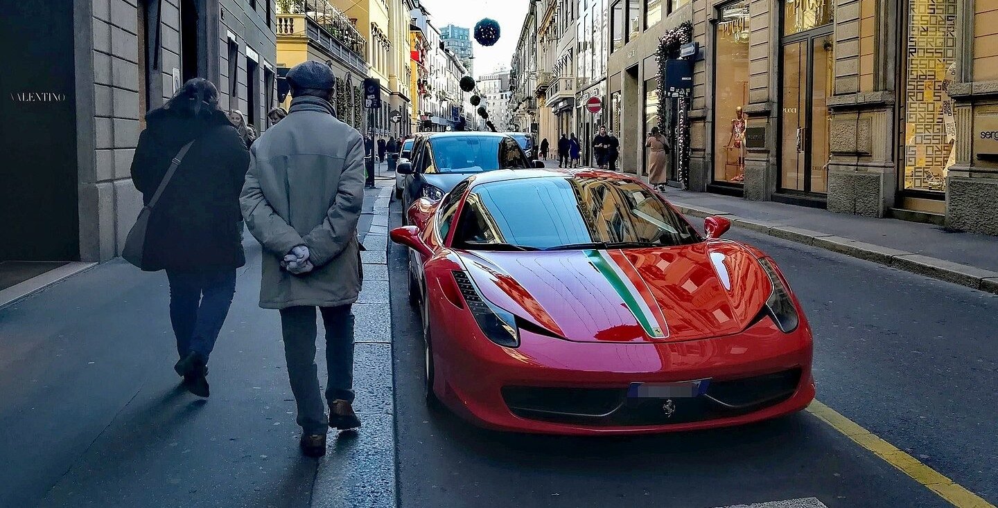
    The use of a private car is generally discouraged, especially in central areas, due to traffic and the presence of Area C and other restricted zones. Access is controlled by electronic gates, so it is important to check schedules, costs, and restrictions in advance.

    To better orient yourself and understand the layout of the districts, it can be useful to join a walking tour or a panoramic tour, ideal for gaining practical references and moving with greater confidence in the following days (see more info 🔗).

    In recent years, numerous alternative mobility solutions have also become popular, such as bicycles, electric scooters, and sharing services. These modes are particularly suitable for Milan, a flat city with bike lanes, but should be used with caution in busy areas.


    Milan is one of Italy’s and Europe’s main transport hubs, easily reachable thanks to an efficient network of air, rail, road, and long-distance transport connections. Its strategic position in Northern Italy makes it an ideal destination for tourism, work, and study.

    By Plane

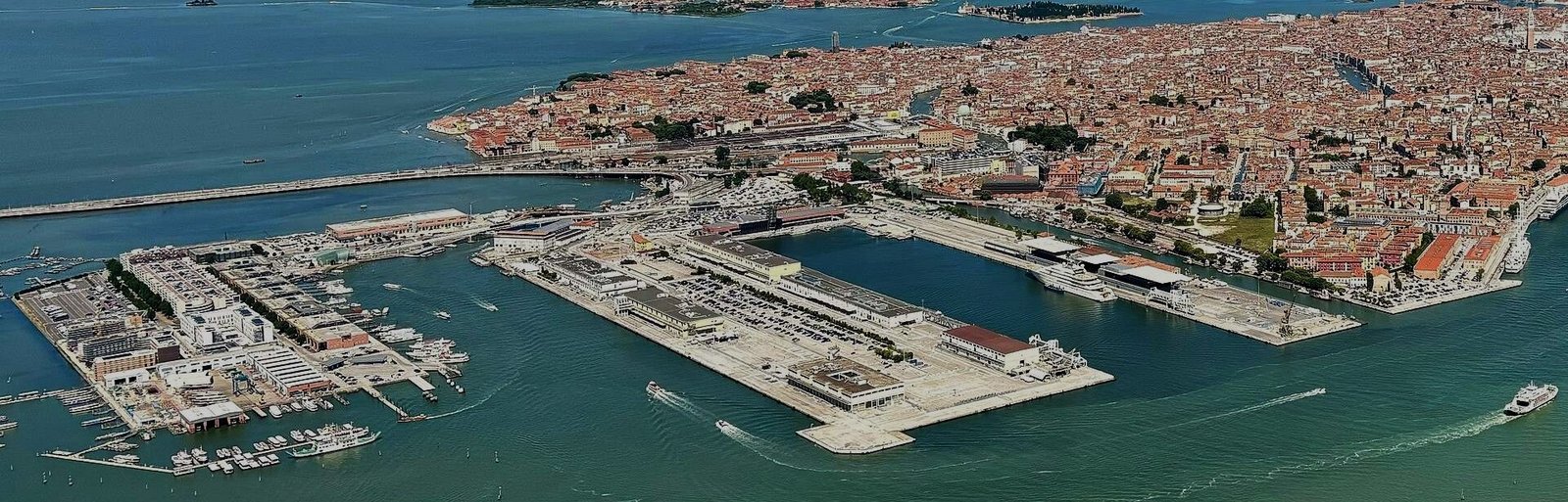
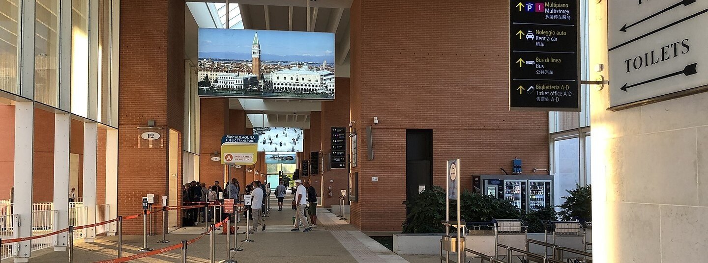
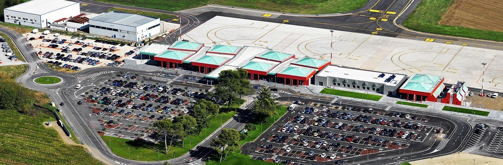
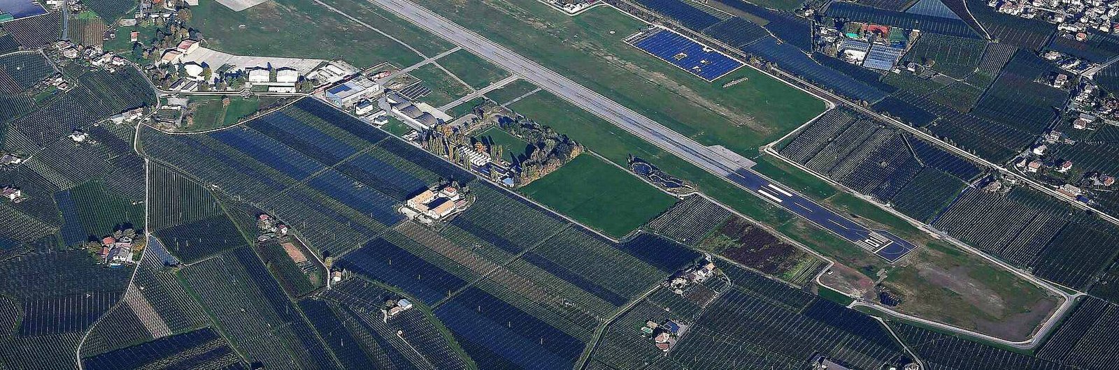
    Milan Malpensa Airport (see info & tips 🔗) and Milan Linate Airport (see info & tips 🔗) offer numerous domestic and international connections, including low-cost flights. From the airports, the city center can be reached via dedicated trains, buses, taxis, private transfers, or rental cars, with travel times typically between 20 and 60 minutes.

    ✅ To search or book a flight to/from Milan, you can use Booking.com Flights.

    By Train

    Milan Centrale is the main railway station, connected to major Italian and European cities via high-speed trains, Intercity, and regional services. Other important stations include Milano Porta Garibaldi, Milano Rogoredo, and Milano Cadorna. All are well integrated with the metro, tram, and bus network.

    ✅ Check routes, schedules, prices, and book tickets with Trainline.

    By Car

    Milan is connected to the main highways in Northern Italy, including the A1, A4, A7, and A8. Drivers should consider Area C and other restricted traffic zones, as well as often heavy traffic. It is advisable to use park-and-ride facilities or garages outside the city center.

    ✅ For car rental, you can use Booking.com Cars.

    By Bus

    Milan is well connected to numerous Italian and European cities via long-distance buses. Major stops are located near train stations and city hubs, with direct connections to the center and peripheral areas via the ATM urban network.

    ✅ Check routes, schedules, and book tickets with Trainline.

    By Taxi or Private Transfer

    Taxis and private transfer services allow direct and comfortable travel to Milan from airports, railway stations, or nearby cities. Travel times vary depending on traffic and distance, making this a practical option for travelers with luggage or those preferring direct transfers.


    Walking is one of the best ways to explore Milan, especially in the central areas where many of the main attractions are located within short distances of each other.

    City center and historic districts

    The center of Milan is particularly suited for walking: areas such as the Duomo, Galleria Vittorio Emanuele II, Brera, Castello Sforzesco, and Navigli can be connected with pleasant walks. Neighborhoods like Porta Nuova and Isola also offer interesting and well-organized urban routes.

    Distances and walking times

    Distances in the city center are generally short: from the Duomo to Brera it takes about 10–12 minutes on foot, while from the Duomo to the Castello Sforzesco it takes around 15–18 minutes. Longer routes, such as from the Castello to the Navigli, take about 35–40 minutes, but are pleasant and flat.

    Road surface and comfort

    Milan mostly features asphalt streets and regular sidewalks, with some cobbled or stone areas in historic districts. The flat terrain makes the city ideal for long walks, but it is still recommended to wear comfortable shoes, especially for longer distances.

    Traffic and crossings

    When walking, it is important to pay attention to urban traffic, especially in central areas and along main streets. Trams, bicycles, scooters, and cars often share the same space. It is recommended to always use crosswalks and follow traffic signals.

    Safety and walkability

    Milan is generally a safe and well-lit city for walking, especially in central and tourist areas. As in any major city, it is advisable to remain vigilant in crowded areas, on public transport, and in the evening near train stations.

    Urban experience

    Walking through Milan allows you to experience the city’s daily rhythm: historic shop windows, hidden courtyards, contemporary venues, and green spaces make every walk an authentic urban experience, where the journey becomes part of the visit itself.


    Milan’s public transport allows you to move quickly between the city center, residential districts, and suburban areas, thanks to an efficient and well-organized network. The public transport system, managed by ATM, includes subways, buses, trams, and suburban rail lines, suitable for short, medium, and long-distance trips alike.

    Subway

    The Milan metro consists of five lines (M1, M2, M3, M4, and M5) that connect the main areas of the city quickly and efficiently. Interchange hubs such as Duomo, Cadorna, Centrale FS, and Garibaldi allow fast line changes, making the metro ideal for avoiding surface traffic.

    City buses

    The bus network covers the entire urban area extensively, connecting suburban neighborhoods, residential areas, and zones less served by the metro. Buses are especially useful for local trips, although during peak hours they can be affected by city traffic.

    Trams

    Trams are among the most characteristic and efficient means of transport in Milan. Many lines cross the city center and follow dedicated routes, ensuring good regularity. They are often appreciated for connecting central and semi-central areas directly.

    Urban and suburban railways

    Milan has an extensive system of suburban rail lines (Passante Ferroviario and S lines), useful for connecting the city center with the hinterland and main metropolitan locations. These connections are integrated into the urban fare system and allow quick travel over longer distances.

    Taxis

    Taxis are easily found at train stations, airports, main squares, and central areas. They offer a convenient solution for direct trips, evening travel, or when carrying luggage. It is recommended to use official taxis or app-bookable services.

    Tickets and passes

    The ATM fare system includes single tickets, daily tickets, and passes valid on the metro, buses, trams, and suburban lines. Convenient solutions are available for those staying multiple days or frequently using public transport. For updated information on fares, schedules, and lines, it is recommended to consult the official ATM website.

    When to use public transport

    Public transport is ideal for medium to long distances, reaching neighborhoods outside the center, train stations, airports, and business districts. In the city center, walking is often the most practical solution, with the metro supporting longer trips.


    Getting around Milan by car can be convenient for arrivals, departures, or trips to neighborhoods outside the city center, but it requires attention, especially due to the presence of Area C, Limited Traffic Zones (ZTL), numerous pedestrian areas, and heavy traffic during peak hours.

    Area C and ZTL

    The center of Milan is regulated by Area C, a paid zone active during specific time slots, with access controlled by electronic gates. Exemptions and restrictions apply to certain categories of vehicles, while fines for unauthorized entry are frequent. Before entering the city center, it is essential to check hours, costs, and access rules.

    Pedestrian areas and city center

    Many central areas, such as the Duomo, Corso Vittorio Emanuele II, Brera, and some streets of the Fashion Quadrilateral, are pedestrian or have heavily restricted access. In these cases, it is recommended to park outside Area C and continue on foot or by public transport.

    Traffic and peak hours

    Traffic in Milan is heavier on weekdays, especially during office opening and closing hours. Major roads and ring roads can experience significant slowdowns. Planning trips outside peak hours helps reduce travel time and stress.

    Parking

    Milan offers on-street parking, paid parking, and numerous multi-story parking lots, often located near the city center or metro stations. Blue lines indicate paid parking, while yellow lines are reserved. Park-and-ride facilities near metro stations are a practical solution to leave your car and continue by public transport.

    When to use a car

    A car is recommended mainly for reaching peripheral areas, zones not directly served by the metro, trips with luggage, or excursions outside the city. To get around the center, public transport and walking are often the most efficient options.

    🅿️ The box below shows our selection of strategic parking spots, chosen for their proximity to the starting points of our itinerary guides. This way, you can leave your car in areas well connected by public transport, ideal for optimizing your visit to Milan.

    Parking
    Type
    Spaces
    Multi-storey
    184
    Multi-storey
    716

    ✅ For more options and online bookings, you can check the ParkingMyCar service, which allows you to find parking throughout the city.


    What is the best way to get around Milan?

    The most efficient way is to combine metro, tram, and walking. Milan is compact and well-connected, making it easy to get around even without a car.

    Is Milan easy to navigate for first-time visitors?

    Yes, the transport network is clear and well-signposted. With a few initial directions, it is easy to orient yourself between the city center and the main neighborhoods.

    📌 See more in the Overview section.


    How do you get to the center of Milan from the airports?

    From Malpensa, Linate, and Orio al Serio airports, you can reach the city center by train, direct bus, taxi, or private transfer services.

    Are Milan’s train stations well connected?

    Yes, stations like Milano Centrale, Garibaldi, and Cadorna are strategic hubs directly connected to the metro.

    📌 See more in the Getting There section.


    Which public transport is the fastest in Milan?

    The metro is the quickest way to cross the city, while trams and buses are ideal for surface travel.

    Do public transport services run in the evening?

    Yes, main lines operate until late, and night lines cover much of the city.

    Are there integrated tickets?

    Yes, ATM tickets allow you to use the metro, tram, and buses with time-based, daily, or multi-day options.

    📌 See more in the Public Transport section.


    Is it worth using a car in Milan?

    Generally no for the city center due to traffic and Area C. Cars are more useful for trips to peripheral areas or outside the city.

    What is Area C?

    It is a controlled traffic zone in central Milan with regulated, paid access during specific time slots.

    How to avoid fines?

    Always check opening hours, access rules, and permitted parking before entering central zones.

    Where is it convenient to park in Milan?

    In multi-storey or interchange parking lots near metro stations, ideal to continue your journey comfortably by public transport.

    📌 See more in the Getting Around by Car section.

  • Getting around Genoa: Info and Tips

    Getting around Genoa: Info and Tips

    Genova, quartiere di San Vincenzo, via Ippolito d'Aste

    Getting around Genoa: Info and Tips

    Quick Guide to Getting Around the City


    Getting Around Genoa may seem complicated at first glance, but by understanding the main means of transportation, the city areas, and the connections between the port, downtown, and suburbs, getting around becomes simple and efficient, allowing you to fully enjoy all the beauty and experiences this city has to offer.


    Getting around Genoa requires a bit of planning due to the city’s layout, which combines a dense, hilly historic center with modern neighborhoods and suburban areas. The presence of inclines, narrow alleys, and a road network that is not always straightforward makes it important to know the main available transportation options and the areas to reach.

    In the historic center and along the carruggi (narrow, winding alleys typical of Ligurian historic centers, such as those in Genoa), walking often remains the most practical solution: the distances between main attractions, such as Porto Antico, Via Garibaldi, and Piazza De Ferrari, are short, and walking allows you to fully appreciate the urban structure and architectural details.

    To reach neighborhoods outside the center or ascend to the hilly areas, Genoa offers a network of public transportation including buses, metro, and funiculars. These effectively connect the center, port, train stations, and residential areas, making movement easier even on busy days.

    Using a private car is generally not recommended in the historic center, where narrow streets, heavy traffic, and the presence of ZTL zones and pedestrian areas limit circulation. Checking permits and available parking is essential to avoid fines or wasted time.

    For first-time visitors to Genoa, a guided walking tour or a panoramic harbor tour can be very useful to understand the city’s layout, navigate alleys and inclines, and acquire practical reference points for later trips (see more info 🔗).

    In recent years, alternative mobility options, such as shared bicycles and electric scooters, have also grown, mainly usable along the coast, promenades, and some flat streets. However, use should be carefully evaluated in hilly or narrow, busy areas.

    Additionally, Genoa has some urban maritime lines that connect the port, coastal neighborhoods, and nearby locations, representing a scenic and convenient alternative to avoid city traffic.


    Genoa is well connected both nationally and internationally, thanks to a complex network of air, rail, road, and maritime links. Its strategic position on the Ligurian Sea makes it easily reachable for tourism, business, or as a starting point for the Riviera and main destinations in Northern Italy.

    By plane

    The Genoa Cristoforo Colombo Airport (see more info 🔗) is the city’s main airport and offers national and international connections, including low-cost flights. From the airport, the city center and main train stations can be reached by bus, taxi, transfer services, or rental car, with travel times averaging 15–30 minutes depending on the destination.

    ✅ To search or book flights from/to Genoa, you can check Booking.com Flights.

    By train

    Genoa Piazza Principe and Genoa Brignole are the city’s two main train stations, connected to major Italian cities via high-speed, Intercity, and regional trains. They allow easy access to the historic center, the port, and city districts thanks to the metro, bus network, and pedestrian connections.

    ✅ You can check routes, schedules, prices, and buy tickets with Trainline.

    By car

    Genoa is connected to the national highway network via the A10, A12, and A7 motorways. Drivers should consider the hilly layout of the city, urban traffic, and the presence of ZTL zones and pedestrian areas in the historic center. It is recommended to use park-and-ride facilities, private garages, or structures near main access roads.

    ✅ For car rentals, you can check Booking.com Cars.

    By bus

    Genoa is connected to numerous Italian and European cities via long-distance buses, with main stops near train stations and major urban hubs. Connections are well integrated with the local public transport network, facilitating travel to the historic center and port.

    ✅ You can check routes, schedules, and buy tickets with Trainline.

    By taxi or private transfer

    Taxis and private transfer services allow direct and comfortable access to Genoa from the airport, train stations, or nearby locations. Travel times vary depending on traffic and final destination, making this a convenient solution for travelers with luggage or who prefer door-to-door transport.

    By ship

    The Port of Genoa (see more info 🔗) is one of the main ports in the Mediterranean and an important maritime gateway to the city. The port is directly connected to the historic center and train stations via public transport, taxis, and pedestrian paths, making arrival particularly convenient for those traveling by ferry or cruise ship.

    ✅ You can check schedules, companies, and maritime connections with DirectFerries.


    Walking is one of the best ways to explore Genoa, especially within the historic center, where many attractions, museums, and points of interest are located close to each other. Walking allows you to immerse yourself in the carruggi, discover hidden corners, and experience the authentic soul of the city.

    Historic center and carruggi

    The historic center of Genoa is perfect to explore on foot: areas such as Via Garibaldi, Piazza De Ferrari, Porto Antico, San Lorenzo Cathedral, and the Molo district are easily reachable with short walks. Narrow alleys and small squares make moving around surprisingly fast.

    Distances and travel times

    Many trips in the center take little time: from Piazza De Ferrari to Porto Antico is about 10 minutes on foot, while from Via Garibaldi to San Lorenzo Cathedral it takes less than 5 minutes. Longer routes, such as from the center to Belvedere Castelletto, require more time or the use of public elevators and funiculars.

    Hills and slopes

    Genoa is a very hilly city: many streets have steep inclines, staircases, and significant elevation changes. It is important to consider the terrain and plan routes, possibly combining walking with public elevators and funiculars.

    Road surface and comfort

    The road surface in the historic center is often uneven, with cobblestones, ancient pavements, and steps. Therefore, it is strongly recommended to wear comfortable and non-slip shoes, especially if planning long walks.

    Traffic and safety

    Vehicle traffic in the historic center is limited, but it is still necessary to watch out for scooters, service vehicles, and bicycles. Genoa is generally safe to explore on foot, but as in any large city, it is advisable to remain attentive in crowded areas and during evening hours.

    Urban experience

    Walking through Genoa means living an intense and authentic urban experience: medieval alleys, historic buildings, shops, sea views, and sudden panoramic openings make every journey part of the discovery, turning the route itself into a continuous exploration.


    Public transport in Genoa allows you to move between the historic center, residential neighborhoods, hilly areas, and the port area, covering a long and complex city. The public transport system consists of metro, buses, funiculars, elevators, and urban railway services, providing solutions suitable for both short and more complex trips.

    Metro

    The Genoa metro has a single line connecting the Brin area to Brignole, crossing the city center and stopping at strategic points such as Darsena, San Giorgio, and De Ferrari. Although short, it is very useful for moving quickly between the port, historic center, and railway stations.

    Urban buses

    The AMT bus network is extensive and well-connected, with numerous lines linking the historic center, hilly neighborhoods, residential areas, and suburbs. Buses are essential for getting around a city with a complex layout, although they can be affected by traffic during peak hours.

    Funiculars and elevators

    A distinctive feature of Genoa’s public transport is the presence of funiculars and public elevators, used to overcome the steep differences in elevation between the center and hilly areas. Connections to Castelletto, Righi, or Montegalletto are integral to the urban network and also offer a panoramic experience.

    Urban and suburban trains

    Genoa also has urban and suburban railway services connecting the center with coastal neighborhoods and towns along the Riviera. Genova Piazza Principe and Genova Brignole stations serve as main hubs for quick east-west travel.

    Taxis

    Taxis are available at the airport, railway stations, the port, and main city squares. They offer a convenient solution for direct trips, nighttime travel, or journeys with luggage, especially to hilly areas less served by public transport.

    Tickets and passes

    The fare system offers single tickets, daily tickets, and passes valid on buses, metro, funiculars, and elevators. Integrated solutions are particularly convenient for longer stays or frequent public transport users. For up-to-date information on fares, schedules, and routes, it is recommended to consult the official AMT website.

    When to use public transport

    Public transport is especially useful for reaching hilly neighborhoods, suburban areas, railway stations, the port, and for covering medium-long distances. In the historic center, however, walking often remains the most practical and efficient option.


    Getting around Genoa by car can be useful for reaching some hilly areas, the western and eastern districts of the city, or nearby destinations. However, in the historic center and the most frequented areas, the urban layout, traffic, and circulation restrictions often make driving less practical than using public transport.

    Limited Traffic Zones (ZTL)

    Genoa has several active Limited Traffic Zones (ZTL), mainly in the historic center, such as the Porto Antico, Caricamento, and the inner alley areas. Access points are electronically monitored and entry is allowed only for residents and authorized vehicles. Checking activation times is essential to avoid fines.

    Historic center and road layout

    The historic center of Genoa is one of the largest in Europe and is characterized by narrow streets, one-way roads, and large pedestrian areas. Driving inside the narrow alleys is not recommended; it is better to park outside and continue on foot or by bus and metro.

    Traffic and peak hours

    Traffic in Genoa can be heavy during peak hours, especially along the main coastal routes and the connections between the city center and the hilly districts. Highway access points and port areas may also experience congestion. Planning trips outside peak times is strongly recommended.

    Parking options

    The city offers on-street parking, paid blue-line parking, and numerous parking garages, especially near the center, the port, and train stations. Park-and-ride facilities connected to public transport are a practical solution to avoid central traffic.

    Urban roads and elevated highway

    The Sopraelevata Aldo Moro allows fast travel along part of the city’s waterfront and is often used for quick movements between west and east. However, it can become congested during peak hours. Urban roads are often multi-level, with steep climbs and descents.

    When driving is convenient

    Driving is particularly useful for reaching hilly neighborhoods, areas less served by public transport, beaches outside the city center, or for excursions around Genoa. To visit the historic center and main tourist areas, public transport or walking is often more convenient.

    🅿️ The box below shows our selection of strategic parking areas, chosen for their proximity to the starting points of our itineraries. This allows you to leave your car in central or well-connected areas, ideal for optimizing your visit.

    Parking
    Type
    Spaces
    Multi-storey
    230
    Multi-storey
    250

    ✅ For more options and online bookings, you can check the ParkingMyCar service, which allows you to find parking throughout the city.


    What is the best way to get around Genoa?

    The most effective approach is to combine different solutions: walking in central and historic areas, using public transport such as buses, metro, and funiculars to overcome elevation changes and distances, and limiting car use to when it is truly necessary.

    Is Genoa difficult to explore for first-time visitors?

    It may seem complex due to its vertical layout and the narrow alleys of the historic center, but once the main connections are understood, getting around becomes intuitive and practical.

    📌 Learn more in the Overview section.


    How do you get to the center of Genoa from the airport?

    From Genoa Airport, the city center can be reached by dedicated buses, taxis, ride-sharing services, or rental cars.

    Are Genoa’s railway stations well connected?

    Yes, Genoa Piazza Principe and Genoa Brignole stations are well connected to the city center and main districts by buses, metro, and urban transport services.

    Is the Port of Genoa easily accessible?

    Yes, the port and the Old Port area are well connected to the city center and can also be easily reached on foot from the main tourist areas.

    📌 Learn more in the Getting There section.


    What are the most convenient public transport options in Genoa?

    Buses, the metro, and vertical transport such as funiculars and elevators are essential for getting around quickly, especially to overcome the city’s steep elevation changes.

    Does public transport work well in Genoa?

    The service is generally efficient, with a widespread network covering the city center, hillside districts, and coastal areas, although delays may occur during peak hours.

    Are there integrated tickets available?

    Yes, the fare system includes tickets and passes valid on buses, metro lines, funiculars, and city elevators.

    📌 Learn more in the Public Transport section.


    Is it worth using a car in Genoa?

    Only in certain situations. Between limited traffic zones (ZTL), narrow streets, and congestion, driving is often impractical in the historic center.

    Where is it best to park?

    In selected public or private parking facilities, especially near central areas or close to public transport interchange hubs.

    How can you avoid fines and penalties?

    By checking active limited traffic zones, pedestrian areas, and parking regulations in advance, particularly in the historic center.

    📌 Learn more in the Getting Around by Car section.


  • Getting around Rome: Info and Tips

    Getting around Rome: Info and Tips

    Piazza Venezia a Roma

    Getting around Rome: Info and Tips

    Quick Guide to Getting Around the City


    Rome is a vast city, rich in history and urban layers, where getting around may seem complicated at first glance. In reality, once you understand the main means of transport and the layout of the city’s areas, moving around Rome becomes easier and more efficient than one might imagine.


    Getting around Rome requires a minimum of planning, given the size of the city and the complexity of its urban fabric. The capital covers a very large area and combines historic districts, modern neighborhoods, and peripheral zones, each served by different means of transport.

    In the historic center, where many of the main monuments and points of interest are concentrated, getting around on foot is often the best option: distances are relatively short and allow visitors to experience the city more freely, avoiding traffic and waiting times.

    To cover longer distances or reach neighborhoods outside the center, Rome offers an extensive public transport network made up of metro lines, buses, and trams. Although not always particularly fast, the system effectively connects major tourist areas, railway stations, and key hubs across the city.

    The use of a private car is generally not recommended, especially in central areas, due to heavy traffic and the presence of a large Limited Traffic Zone (ZTL). Electronic access gates regulate entry to many historic districts, making it essential to check schedules and permits in advance.

    A useful support for first-time visitors to Rome can be a guided walking tour or a panoramic tour, which help in understanding the city’s structure, navigating between districts and major urban axes, and gaining practical reference points for subsequent travel (see in-depth guide🔗).

    Finally, in recent years alternative mobility solutions have also grown, such as bicycles, electric scooters, and sharing services, mainly usable in flatter areas and along dedicated routes. However, their use should be carefully evaluated in more congested areas or where road surfaces are uneven.


    Rome is well connected both nationally and internationally, thanks to a well-developed network of air, rail, road, and maritime connections. Its strategic location in central Italy makes it easily accessible for tourism, study, or work.

    By plane

    Rome Fiumicino Airport (see in-depth guide 🔗) and Rome Ciampino Airport (see in-depth guide 🔗) are served by numerous national and international flights, including low-cost connections. From the airport, you can reach the city center by regional trains and the Leonardo Express, buses, taxis, private transfers, or rental cars, with average travel times of 30–50 minutes depending on the destination.

    ✅ To search for or book flights to/from Rome, you can check Booking.com Flights.

    By train

    Rome Termini is the city’s main railway station, connected to all major Italian cities by high-speed, Intercity, and regional trains. Other important stations include Rome Tiburtina and Rome Ostiense. From the stations, you can quickly reach the historic center, outer districts, and main attractions by metro, bus, tram, or on foot.

    ✅ You can check routes, timetables, prices, and buy tickets with Trainline.

    By car

    Rome is connected to the main Italian motorways, including the A1, A12, and A24. Those arriving by car should consider the presence of an extensive Limited Traffic Zone (ZTL) in the historic center, as well as heavy traffic in many areas. It is advisable to use park-and-ride facilities, private garages, or accommodations located outside the center.

    ✅ For car rental, you can refer to Booking.com Cars.

    By bus

    Rome is connected to many Italian and European cities by long-distance buses, with main stops near railway stations and urban hubs. Services are integrated with the city’s bus and tram network, making transfers to the historic center and main attractions easy.

    ✅ You can check routes, timetables, and buy tickets with Trainline.

    By taxi or private transfer

    Taxis and private transfer services allow you to reach Rome directly and comfortably from both airports, railway stations, or nearby cities. Travel times vary depending on the departure point and traffic conditions, offering a convenient option for those who prefer door-to-door travel.

    By ship

    For those arriving by sea, the Port of Civitavecchia (see in-depth guide 🔗) is about 80 km from Rome’s city center and represents the main maritime gateway to the capital. It is connected to the city by regional trains, buses, and private transfer services, with average travel times of 50–70 minutes.

    ✅ You can check ferry schedules, companies, and available routes using DirectFerries.


    Walking is one of the best ways to explore Rome, especially within the historic center, where many of the city’s main monuments and points of interest are located relatively close to one another. Walking allows you to discover hidden corners, monumental squares, and unique views that are often missed when using public transport.

    Historic center and districts

    The historic center of Rome is ideal for exploring on foot: areas such as the Pantheon, Piazza Navona, Campo de’ Fiori, Trevi Fountain, Spanish Steps, and Trastevere are easily connected by short walks. Distances between attractions are often shorter than they appear on the map.

    Distances and walking times

    Many routes within the historic center require limited time: for example, it takes about 5–7 minutes on foot from the Trevi Fountain to the Pantheon, while walking from Piazza Navona to Campo de’ Fiori takes less than 10 minutes. Slightly longer routes, such as from the Spanish Steps to the Colosseum, take around 30–35 minutes.

    Road surface and comfort

    Rome features varied road surfaces, including cobblestones, paving stones, and asphalt, especially in historic areas. For this reason, it is strongly recommended to wear comfortable walking shoes suitable for long distances, avoiding rigid footwear or thin soles.

    Traffic and crossings

    When walking, it is important to pay attention to urban traffic, especially at road crossings. Even in central areas, traffic from cars, scooters, and buses can be intense. It is always advisable to use pedestrian crossings and cross carefully.

    Safety and livability

    Rome is generally a safe city to explore on foot, especially in central and tourist areas. As in any large metropolis, it is advisable to remain alert in very crowded areas and during the evening hours, particularly near train stations and major transport hubs.

    Urban experience

    Walking through Rome means experiencing the city authentically: historic alleys, hidden churches, monumental squares, fountains, and small shops make every journey an integral part of the travel experience, turning a simple walk into a continuous discovery.


    Rome’s public transport system allows you to move between the historic center, residential districts, and peripheral areas, covering a very large and complex city. The public transport network consists of metro lines, buses, trams, and urban railways, offering solutions suitable for both short trips and medium-to-long distances.

    Metro

    The Rome metro mainly consists of three operating lines (A, B/B1, and C) connecting different areas of the city and several major tourist attractions. Lines A and B intersect at Roma Termini, allowing quick transfers. The metro is particularly useful for avoiding surface traffic.

    City buses

    The bus network is extensive and widespread, with hundreds of routes linking the historic center, railway stations, suburban districts, and areas not served by the metro. Buses are essential for reaching many parts of the city, although they may be affected by traffic during peak hours.

    Trams

    Trams operate along several strategic corridors and offer a more regular alternative to buses, especially on dedicated tracks. Lines running through Trastevere or connecting the city center with nearby districts are often appreciated for their reliability.

    Urban and suburban railways

    Rome also features urban railway lines such as Roma–Lido, Roma–Viterbo, and Roma–Giardinetti, which are useful for connecting the city center with certain suburban areas and nearby towns. These services are integrated into the city’s public transport system.

    Taxis

    Taxis are available at airports, railway stations, major squares, and tourist areas. They are a convenient option for direct trips, evening travel, or when carrying luggage. It is advisable to use official taxis and check the applicable fares.

    Tickets and passes

    The fare system includes single tickets, daily passes, and travel cards valid on the metro, buses, trams, and urban railways. Cost-effective options are available for visitors staying several days and frequently using public transport. For updated information on fares, schedules, and routes, it is recommended to consult the official ATAC website.

    When to use public transport

    Public transport is particularly suitable for covering medium-to-long distances, reaching areas outside the historic center, railway stations, business districts, and attractions that are not easily accessible on foot. Within the historic center, however, walking is often the most practical option.


    Getting around Rome by car can be convenient for arrivals, departures, or travel to peripheral areas, but it requires attention, especially due to the presence of Limited Traffic Zones (ZTL), numerous pedestrian areas, and heavy traffic during peak hours.

    Limited Traffic Zones (ZTL)

    Rome’s historic center is regulated by several ZTLs active during specific time slots, with access restricted to residents and authorized vehicles. Electronic gates automatically monitor entrances, and fines are common. Before entering the city center, it is essential to check schedules, activation days, and the type of ZTL in force.

    Pedestrian areas and historic center

    Many central areas, such as those around Piazza di Spagna, Trevi Fountain, the Pantheon, and the Imperial Forums, are fully pedestrian or have very limited access. In these cases, it is advisable to park outside the center and continue on foot or by public transport.

    Traffic and peak hours

    Traffic in Rome is particularly heavy on weekdays, especially in the morning and late afternoon. Major consular roads and the ring road (GRA) can experience significant delays. Planning travel outside peak hours helps reduce stress and travel time.

    Parking and stopping

    Rome offers on-street parking, paid parking areas, and numerous multi-storey car parks, often located near the city center or metro stations. Blue lines indicate paid parking, while white lines are free of charge. Park-and-ride facilities near metro stops are a practical solution for leaving your car and continuing by public transport.

    When it makes sense to use a car

    Using a car is recommended mainly for reaching peripheral areas, zones not served by the metro, traveling with luggage, or taking trips outside the city. For moving around the historic center, public transport and walking are often the most effective choices.

    🅿️ The box below shows our selection of strategically located parking areas, chosen for their proximity to the starting points of our guided itineraries. This allows you to leave your car in central areas or well connected by public transport, ideal for making the most of your visit.

    Parking
    Type
    Spaces
    Underground
    220
    Underground
    1800
    Outdoor
    1800
    Underground
    715

    ✅ For more options and online bookings, you can check the ParkingMyCar service, which allows you to find parking throughout the city.


    What is the best way to get around Rome?

    The most effective way is to combine different modes of transportation: walk in the historic center, use the metro, buses, and trams for longer distances, and limit car use to when it’s necessary.

    Is Rome difficult to navigate for first-time visitors?

    It may seem complex at first, but once you understand the layout of neighborhoods and main transport options, getting around becomes easy and efficient.

    📌 Learn more in the section Overview.


    How can I reach central Rome from the airport?

    From Fiumicino or Ciampino airports, you can reach the center via direct trains, shuttle buses, taxis, private transfers, or rental cars.

    Is Rome’s main train station well connected to the city?

    Yes, Roma Termini is the main rail and metro hub, with efficient connections to the city center and major tourist destinations.

    Is the port of Civitavecchia easily accessible from Rome?

    Yes, there are direct rail and road links, as well as private shuttle services from main city points.

    📌 Learn more in the section Getting There.


    What are the fastest public transport options in Rome?

    The metro, trams, and rapid buses are the quickest for covering longer distances, while walking is ideal in the historic center.

    Do buses and trams run reliably in Rome?

    They cover many areas, but can experience delays due to traffic, especially during peak hours.

    Are there integrated tickets for multiple transport modes?

    Yes, the fare system offers tickets valid on metro, buses, and trams, with daily and multi-day options.

    📌 Learn more in the section Public Transport.


    Is it worth using a car in Rome?

    Only in certain situations. Heavy traffic, ZTL zones, and pedestrian areas often make driving inconvenient in the historic center.

    Where is the best place to park?

    In selected public or private parking lots, preferably near the starting points of our itineraries or in areas well connected by public transport.

    How can I avoid fines and penalties?

    By checking ZTL zones, pedestrian areas, and permitted access times in advance.

    📌 Learn more in the section Getting Around by Car.


  • Getting around Trieste: Info and Tips

    Getting around Trieste: Info and Tips

    Trieste, Via Nazario Sauro

    Getting around Trieste: Info and Tips

    Quick Guide to Getting Around the City


    Trieste is a fascinating, elegant, and historically rich city, where getting around may seem complex at first, but becomes simple and enjoyable once you understand the layout of its neighborhoods and the available transportation options.


    Getting around Trieste is generally easy, thanks to an efficient public transport network and a compact city that is very walkable. However, some historic areas and the seafront require a bit of orientation to move around comfortably.

    The main advice is to combine different modes of transportation: walk in central areas such as Piazza Unità d’Italia or the Borgo Teresiano, use buses and trams for longer distances, and consider taxis or ride-sharing services only when necessary.

    For a first approach to the city, it can be useful to join a guided walking tour or a free walking tour, perfect for orienting yourself, discovering hidden corners, and getting practical tips from locals (🔗learn more).

    Trieste has varied terrain: some hilly areas like the Carso offer scenic routes and alternative connections, while the historic center and the seafront are flat and ideal for strolling. Funiculars such as the Opicina line or urban elevators can make getting around easier.

    Finally, keep in mind that Trieste is very sea-oriented: the seafront and the port are key points, so planning pedestrian or cycling routes will allow you to experience the city more smoothly and enjoyably.


    Trieste is easily accessible both from Italy and abroad thanks to an efficient network of air, rail, and road connections. Its location on the northeastern border and its role as a port city make it a strategic point for travelers for tourism or work.

    By plane

    The Trieste – Friuli Venezia Giulia Airport (see more info 🔗) is about 33 km from the city center and is connected to several national and international destinations, including low-cost flights. From the airport, it is possible to reach the center by bus, taxi, private transfer, or rental car, with average travel times of 30–40 minutes.

    ✅ To search or book a flight to/from Trieste, you can consult Booking.com Flights.

    From the Port of Trieste

    The Port of Trieste (see more info 🔗) is one of the main commercial and tourist ports of the northern Adriatic. Thanks to connections with the city center via taxi, bus, and pedestrian routes, it is possible to reach Trieste quickly, whether arriving from cruises or ferries.

    ✅ You can check schedules, companies, and available maritime connections with the DirectFerries service.

    By train

    Trieste Centrale is the main railway station of the city and is connected to several Italian cities, including Venice, Udine, and Milan, via high-speed trains, Intercity, and regional services. The station is located near the center, making it easy to reach main tourist attractions on foot or by public transport.

    ✅ You can check routes, schedules, prices, and buy tickets via Trainline.

    By car

    Trieste is accessible via the main highways of northeastern Italy, including the A4 (Turin–Trieste) and the A23 (Udine–Tarvisio). Drivers should consider the presence of ZTL zones in the historic center and limit car use in central neighborhoods. It is recommended to use public parking or private facilities outside the center.

    ✅ For car rentals, you can consult Booking.com Cars.

    By bus

    Trieste is connected to other Italian and European cities via long-distance buses. The main stops are located near the central station and city center, perfectly integrated with urban public transport to quickly reach the seafront and main attractions.

    ✅ You can check routes, schedules, and purchase bus tickets with TrainLine.

    By taxi or private transfer

    Taxis and private transfer services allow you to reach Trieste from airports, stations, or nearby locations directly and comfortably. Travel times vary depending on the departure point and traffic. They are especially convenient for travelers with luggage or in groups.

    ✅ Recommended for connections from the airport or the Port of Trieste to the city center or surrounding hilly areas.


    Exploring Trieste on foot is one of the best ways to discover the city, which is compact, flat in the downtown and waterfront areas, but features hilly zones offering stunning views. Walking allows you to discover historic corners, squares, and the port without using public transport.

    Historic center

    The historic center of Trieste is perfect for walking: areas such as Piazza Unità d’Italia, Via San Nicolò, Via Mazzini, and Borgo Teresiano are all reachable on foot. Distances are short, and the city is easily navigable by walking.

    Waterfront and port

    The Trieste waterfront and port area are ideal for scenic walks with unmatched views of the gulf and surrounding hills, making moving around pleasant even for those who want to take photos or stop at one of the many historic cafés.

    Hilly areas

    Some parts of the city, like the San Giusto hill, require more demanding walks. However, well-marked streets and paths allow you to enjoy unique views of the city and the sea.

    Safety and livability

    Trieste is generally safe and pedestrian-friendly. As in any city, it is advisable to be cautious in the evening or in isolated areas, but the city center and main tourist areas are well-frequented and well-lit.

    Footwear and comfort

    Streets in the center and along the waterfront are mostly paved or cobbled, while historic districts may have pebbles or stone blocks. Comfortable shoes are essential for moving easily and exploring the hilly areas without difficulty.

    Urban experience

    Walking through Trieste allows you to experience the city authentically: historic cafés, bookstores, markets, squares, and architectural corners become part of the travel experience, offering the chance to discover hidden gems and breathtaking sea views.


    Public transport in Trieste allows easy movement between the historic center, the waterfront, residential neighborhoods, and the surrounding hilly areas. The system is mainly based on urban and suburban buses, with strategic connections to cover medium-long distances without using a private car.

    Elevators and funiculars

    Trieste is famous for its multi-level historic center and hills overlooking the city. To move around comfortably, you can use public elevators and funiculars, connected to several central and scenic areas. The main ones include the Opicina Funicular, the Castle Funicular, and the Barcola Elevator. These services provide quick connections between the waterfront, historic center, and hilly areas, saving time while offering panoramic views of the city and sea.

    Urban and suburban buses

    The bus network covers the entire city and surrounding areas, connecting the historic center, train station, port, and suburban districts. Main lines allow rapid transfers between tourist attractions and residential areas, while suburban lines link Trieste to nearby towns and the Karst region.

    Main lines and strategic connections

    Some lines run along central axes like Via Roma, Corso Italia, and the waterfront, facilitating quick transfers between the station, historic center, and port. Buses are particularly useful for visiting hilly areas or neighborhoods outside the pedestrian center.

    Rail transport

    Unlike other cities, Trieste does not have a metro. However, Trieste Centrale station is a key hub for regional and high-speed trains, allowing fast connections to Udine, Venice, and nearby towns.

    Taxis and private transfers

    Taxis and private transfer services are available at the station, airport, and city center. They are convenient for reaching hilly areas, the port, or locations less served by buses. It is advisable to check rates before departure.

    Tickets and passes

    The fare system includes single tickets, daily tickets, and passes valid throughout the urban network. Options are available for both tourists and residents. For up-to-date information on schedules and fares, consult the official website of Trieste public transport.

    When to use public transport

    Public transport is ideal for reaching suburban neighborhoods, the Karst, or hilly areas. In the historic center and along the waterfront, walking is often faster and allows you to enjoy views, squares, and the panorama over the gulf.


    Getting around Trieste by car can be useful in some situations, for example to reach locations outside the city center like Miramare Castle or the Carso area, but it requires attention for parking management, access restrictions, and traffic in some parts of the city.

    Limited Traffic Zones (ZTL): in the historic center and in some areas near main attractions, there are limited traffic zones. Access to these areas is regulated and may require a permit from the municipality; entering with an unauthorized vehicle can result in automatic fines via cameras. It is recommended to check the ZTL zones before planning car trips.

    Pedestrian areas and urban traffic: some streets in the center are pedestrian or subject to traffic restrictions, making it difficult to use the car directly near main attractions such as Piazza Unità d’Italia or the Rive. In these areas, it is generally better to park and continue on foot or by public transport.

    Practical tips: since traffic and parking availability can be limited, especially during peak hours and tourist periods, it may be easier to leave the car in a structured parking lot or a less central area and reach the city center by bus or on foot.

    Parking:

    Trieste uses a colored line parking system. Blue lines are paid on weekdays and during regulated hours, while some white lines may be free or have time limits. Availability of spaces in the historic center is often limited, so planning ahead is recommended.

    To make car travel easier, many visitors prefer structured parking lots or areas slightly outside the center, reachable also by city buses. Alternatively, parking in free residential areas and continuing on foot can be an option, but requires knowledge of local signage.

    During special events such as the Barcolana regatta or other festivals, some streets may be closed to traffic and parking availability may decrease further: keep this in mind when planning your car itinerary.

    🅿️ The box below shows our selection of strategic parking lots, chosen for their proximity to the starting points of our guides’ itineraries. This way, you can leave your car in central areas or well-connected to public transport, ideal to make the most of your visit.

    Parking Type Spaces
    Area di parcheggio Molo 4 Outdoor 600
    Parcheggio Saba Maggiore Multilevel 590
    Interparking Italia Srl Park San Giusto Multilevel 300
    Parcheggio Saba Silos Multilevel 780

    ✅ For more options and online bookings, you can check the ParkingMyCar service, which allows you to find parking throughout the city.


    What is the best way to get around Trieste?

    Combine multiple modes: walk in central areas, use buses and funiculars for longer distances, and limit car use to what’s necessary.

    Is Trieste difficult to explore for first-time visitors?

    No, the city is compact and easily walkable, with excellent public transport connections.

    📌 Learn more in the Overview section.


    How do you reach Trieste city center from the airport?

    By bus, taxi, private transfer, or rental car (approximately 30–40 minutes).

    Is the Port of Trieste well connected to the city?

    Yes, taxis, buses, and pedestrian routes allow quick access to the city center.

    Is Trieste well connected by train?

    Yes, Trieste Centrale connects the city to Udine, Venice, Milan, and other Italian cities.

    📌 Learn more in the Getting There section.


    What are the fastest public transport options in Trieste?

    Buses cover the entire city, and funiculars or urban elevators are useful for overcoming elevation differences.

    Are there integrated tickets?

    Yes, single, daily, and subscription tickets are valid on the urban and suburban network.

    📌 Learn more in the Public Transport section.


    Is it convenient to get around Trieste by car?

    Only in certain situations, such as reaching Miramare Castle or the Karst region. In the historic center, cars are less practical due to ZTL zones and pedestrian areas.

    Where is it best to park?

    In authorized public or private parking lots, preferably outside the historic center.

    How to avoid fines and penalties?

    By checking ZTL zones, pedestrian areas, and allowed access times.

    📌 Learn more in the Getting Around by Car section.

  • Getting around Bologna: Info and Tips

    Getting around Bologna: Info and Tips

    Bologna, portico di Strada Maggiore con vista Basilica di Santa Maria dei Servi

    Getting around Bologna: Info and Tips

    Quick Guide to Getting Around the City


    Bologna is a compact, orderly, and welcoming city, where getting around is generally simple and intuitive, especially if you know the main means of transport and the key areas of the historic center.


    Getting around Bologna is generally easy and pleasant, thanks to the city’s compact layout and a well-organized historic center. Most of the main attractions are located within the city walls, making travel quick and intuitive even for first-time visitors.

    The main recommendation is to prefer walking in the historic center and use public transportation to reach more distant neighborhoods, the train station, or university areas. The use of a private car is generally discouraged, especially in central areas.

    To get oriented quickly, joining a guided walking tour or a free walking tour can be very helpful. These tours are ideal for understanding the city’s layout, porticoes, and main landmarks, while also receiving practical tips from local guides.

    One important aspect to consider is the presence of a very extensive Limited Traffic Zone (LTZ): access to the historic center is regulated and monitored, with electronic gates active at various times. Those arriving by car should pay close attention to permits and consider park-and-ride facilities or parking areas outside the city walls.

    Finally, Bologna is a predominantly flat city, a feature that makes it particularly suitable for cycling and the use of sustainable mobility services, which are increasingly widespread and well integrated with public transport.


    Bologna is one of the best-connected cities in Italy, easily reachable both from within the country and from abroad thanks to an efficient network of air, rail, and road connections. Its strategic location in Northern Italy makes it a key hub for travelers visiting for tourism, study, or work.

    By plane

    Bologna Guglielmo Marconi Airport (see detailed guide 🔗) is located about 6 km from the city center and is served by numerous domestic and international flights, including low-cost connections. From the airport, the city center can be reached via the Marconi Express, bus, taxi, private transfer, or rental car, with average travel times of 15–30 minutes.

    ✅ To search for or book a flight to/from Bologna, you can check Booking.com Flights.

    By train

    Bologna Centrale is one of Italy’s main railway stations and is connected to major cities via high-speed trains, Intercity, and regional services. From here, it is easy to reach the historic center, university area, and outlying neighborhoods by public transport or on foot.

    ✅ You can check routes, schedules, prices, and purchase tickets with Trainline.

    By car

    Bologna can be reached via the main highways of Northern Italy, including the A1, A13, and A14. Those arriving by car should consider the presence of an extensive Limited Traffic Zone (LTZ) in the historic center; it is advisable to use park-and-ride facilities or parking structures outside the city walls.

    ✅ For car rental, you can refer to Booking.com Cars.

    By bus

    Bologna is also connected to many Italian and European cities by long-distance buses. The main stops are located near the railway station and are well integrated with the urban public transport system.

    ✅ You can check routes, schedules, prices, and purchase tickets with Trainline.

    By taxi or private transfer

    Taxis and private transfer services allow you to reach Bologna from airports, train stations, or nearby cities in a direct and comfortable way. Travel times vary depending on the departure point and traffic conditions.


    Walking is one of the best ways to explore Bologna, a compact, flat city that is perfectly suited for walking. The historic center is concentrated, and many of the main attractions are located within short distances of each other.

    Historic center

    The historic center of Bologna is ideal to explore on foot: areas such as Piazza Maggiore, Via Indipendenza, the Quadrilatero, Via Zamboni and the Two Towers area can be visited entirely without using public transport. Distances are short and orientation is easy.

    The porticoes: a unique advantage

    Bologna is famous for its porticoes, a UNESCO World Heritage Site, which make walking especially comfortable in every season. Walking under the porticoes allows you to move sheltered from rain and sun, making walking practical even in variable weather.

    Distances and walking times

    The main attractions in the center are easily reachable on foot: for example, it takes about 5 minutes to walk between Piazza Maggiore and the Two Towers, while from the railway station to the heart of the historic center it takes around 15–20 minutes.

    Safety and livability

    Bologna is generally a safe and pedestrian-friendly city. As in any large urban center, it is advisable to pay attention in crowded areas and during evening hours, especially near the station and along the busiest streets.

    Footwear and comfort

    The streets of the historic center alternate between asphalt, cobblestones and stone surfaces. Comfortable shoes are recommended to move easily, especially if you plan to walk for long periods under the porticoes or visit several neighborhoods in the same day.

    Urban experience

    Walking around Bologna allows you to experience the city in an authentic way: historic shops, bookstores, markets, cafés under the porticoes and architectural views make walking an integral part of the travel experience.


    Bologna’s public transport system allows easy travel between the historic center, residential neighborhoods, and peripheral areas. The transport network is mainly based on urban and suburban buses, offering efficient solutions for medium- to long-distance trips without the need for a car.

    Urban and suburban buses

    The bus network covers the entire city extensively and represents the main form of public transport. Lines connect the historic center with the railway station, outer districts, and major points of interest. During peak hours, the service may be affected by traffic, but overall it remains reliable.

    Main lines and strategic connections

    Some routes run along the city’s most important axes, such as Via Indipendenza and the ring roads, making it easy to move quickly between the railway station, the historic center, and university areas. For visitors, buses are particularly useful for reaching less central districts.

    Rail transport

    Unlike other large Italian cities, Bologna does not have an urban metro system. However, the railway station is a key hub and allows the use of regional trains for quick trips to nearby towns or surrounding areas.

    Taxis

    Taxis are available in major squares, at the railway station, and in tourist areas. They are a convenient option in the evening, for direct trips, or when traveling with luggage. It is advisable to check fares or request a cost estimate before departure.

    Tickets and passes

    The fare system includes single tickets, daily tickets, and passes valid across the entire urban network. These options are useful for those planning to use public transport frequently during their stay. For up-to-date information on fares and schedules, it is recommended to consult the official public transport website.

    When public transport is most useful

    Public transport is particularly suitable for reaching peripheral areas, university zones far from the center, exhibition grounds, and residential neighborhoods. In the historic center, however, walking is often faster and more efficient.


    Getting around by car in Bologna can be useful in certain situations, but it requires attention, especially due to the presence of the Limited Traffic Zone (ZTL), numerous pedestrian areas and traffic during peak hours.

    Limited Traffic Zone (ZTL)

    The historic center of Bologna is entirely regulated by a ZTL active during specific hours, with access allowed only to residents and authorized vehicles. Unauthorized entry results in automatic fines via electronic gates. Before driving, it is essential to check schedules and restrictions.

    Pedestrian areas and historic center

    Many central areas, especially around the historic porticoes, Piazza Maggiore and the main shopping streets, are pedestrian-only or have heavily restricted traffic. In these cases, it is advisable to park outside the center and continue on foot or by public transport.

    Practical driving tips

    Driving in Bologna is generally more orderly than in other large cities, but it is still advisable to pay attention to ZTL signs, reserved lanes and electronic controls. Car use is mainly recommended for arrivals, departures or trips to peripheral areas.

    ⚠️ City 30 and road safety

    Bologna has extended the City 30 concept across much of the city: the 30 km/h speed limit now applies to about 70% of urban roads, including many streets in the historic center. The goal is to improve safety, reduce noise and pollution, and promote sustainable mobility with bike lanes and pedestrian areas. Only some main roads maintain the 50 km/h limit.

    Stops and Parking

    The city offers numerous public and multi-storey car parks, many located near the historic center. In the box below we highlight five selected car parks: four centrally located and one outside the center, ideal as a park-and-ride facility.

    ⚠️ White and blue parking lines

    In Bologna, white lines do not indicate free parking: they are generally reserved for residents with permits or subject to a parking disc. Only in very rare cases, clearly indicated by signs, is free parking allowed. Blue lines are paid from Monday to Saturday, from 8:00 a.m. to 8:00 p.m., and free in the evening, at night and on public holidays. Always checking vertical signage helps avoid unwanted fines.

    🅿️ The box below shows our selection of strategic parking lots, chosen for their proximity to the starting points of our guides’ itineraries. This way, you can leave your car in central areas or well-connected to public transport, ideal to make the most of your visit.

    Parking
    Type
    Spaces
    Multilevel
    800
    Multilevel
    540
    Outdoor
    325

    ✅ For additional options and online bookings, you can consult ParkingMyCar, which allows you to find parking throughout the city.


    What is the best way to get around Bologna?

    The most effective approach is to combine different transport options: walk in the historic center, use public transport for longer distances, and limit car use to when it is truly necessary.

    Is Bologna easy to explore for first-time visitors?

    Yes, the city is compact and well organized. Knowing the pedestrian areas and main landmarks makes getting around intuitive.

    📌 Learn more in the Overview section.


    How do you reach Bologna city center from the airport?

    From Guglielmo Marconi Airport, you can reach the city center by Marconi Express, bus, taxi, private transfer, or rental car.

    Is Bologna’s train station well connected to the rest of Italy?

    Yes, Bologna Centrale is served by high-speed trains, Intercity, and regional services from all over Italy, making travel within the city and to nearby areas very easy.

    📌 Learn more in the Getting There section.


    What are the main public transport options in Bologna?

    Urban and suburban buses form the main public transport network. There is no underground metro yet, but regional trains quickly connect nearby areas.

    Is it convenient to use public transport in the historic center?

    Walking is often faster, but public transport is useful for reaching peripheral areas, university districts, or the exhibition center.

    Are there integrated tickets for multiple transport options?

    Yes, single tickets, day passes, and subscriptions valid across the entire urban network are available.

    📌 Learn more in the Public Transport section.


    Is it worth getting around Bologna by car?

    Only in certain situations. Traffic, ZTL zones, pedestrian areas, and speed limits often make cars impractical in the historic center.

    Where is the best place to park?

    In authorized public or multi-storey car parks, preferably outside the historic center, or in park-and-ride facilities when using public transport.

    How do white and blue parking lines work?

    White lines are generally reserved for residents or regulated by parking discs, while blue lines are paid parking from Monday to Saturday (8 am–8 pm) and free in the evening, at night, and on public holidays. Always check signage to avoid fines.

    What is “City 30”?

    It is a city-wide project that introduced a 30 km/h speed limit across most of Bologna (about 70%), aiming to improve safety, reduce noise and pollution, and promote sustainable mobility. Only a few main roads retain the 50 km/h limit.

    📌 Learn more in the Getting Around by Car section.

  • Port of Venice: Info & Tips

    Port of Venice: Info & Tips

    Porto di Venezia, vista aerea

    Port of Venice: Info & Tips

    Quick Terminal Guide


    Port of Venice is one of the main maritime ports of the Adriatic Sea and a strategic reference point for cruises, commercial traffic, and passenger connections.


    ✅ You can check schedules, companies, and available maritime connections using the DirectFerries service.

    The Port of Venice (see official website), located in the delicate context of the Venetian Lagoon, plays a key role in maritime connections between Venice, the islands, and the main Mediterranean routes.

    A historic port in the heart of the lagoon

    For centuries, the Port of Venice has been a fundamental hub for European maritime traffic. Today it remains a reference point for cruise tourism and passenger transport, with dedicated terminals and solutions designed to reduce environmental impact in the fragile lagoon ecosystem.

    The port serves a large number of travelers every year and manages:

    • national and international cruise ships
    • ferries and passenger connections to the Adriatic and Mediterranean
    • commercial and cargo traffic
    • maritime services integrated with the lagoon network

    Thanks to its unique location, the Port of Venice represents a privileged gateway to the historic city, the lagoon islands, and the entire Veneto region.

    Main terminals and port areas

    The Venetian port system is divided into several specialized areas and terminals, including those for cruises, ferries, and commercial activities. This organization ensures efficient management of passenger flows and port operations.

    Services, connections, and accessibility

    Within the main port areas, you can find:

    • information points and passenger assistance services
    • waiting areas and essential services
    • water and land connections to Venice and the mainland
    • services for people with reduced mobility

    Schedules, services, and access modes may vary depending on the companies and type of ship, but the Port of Venice guarantees high operability and continuous connections to the historic center, train station, and airport.


    Connections to the Historic Center

    Reaching Venice’s historic center from the port is easy thanks to numerous water and land connections. The main port areas are well integrated with the lagoon public transport system, allowing easy travel even without a car.

    ✅ To rent a car in the port areas or on the mainland, check the Booking.com Car service.

    Vaporetti and Water Connections

    Water connections are the most characteristic and functional way to move from the port to Venice and the lagoon islands:

    • ACTV vaporetti to the historic center and main islands
    • lines dedicated to passenger and cruise terminals
    • water services with frequent connections

    This option is ideal for those who want to reach Venice directly without going via the mainland, enjoying the lagoon scenery.

    ℹ️ Some transfer services also operate near port areas and passenger terminals, with dedicated or easily accessible boarding points.

    Buses and Land Connections

    For those arriving or continuing to the mainland, the port is connected by buses and shuttles to major urban areas:

    • buses to Piazzale Roma and Venice Santa Lucia station
    • connections to Mestre and Marghera
    • quick access to the railway and highway network

    These solutions are practical for those continuing to other cities in Veneto or northern Italy.

    ✅ For train or bus travel, you can search routes, schedules, and tickets directly on TrainLine.

    Taxis and Private Transfers

    Traditional taxis and authorized water taxis are available at main port areas. Private transfers are especially suitable for groups, families, or travelers with large luggage, providing comfort and guaranteed travel times.

    Parking and Stops

    Near the Port of Venice, there are several parking options, both in the port area and on the mainland, ideal for short or long stays.

    • guarded parking in the port area and Marghera
    • private garages connected to the historic center
    • facilities with shuttle service

    ✅ For early booking and convenient rates, even in high season, you can check services like ParkingMyCar.


    Powered by GetYourGuide

    Morning ferries, evening arrivals and early boarding

    Staying near the Port of Venice is a practical solution for those boarding early in the morning, arriving in the city late in the evening, or with tight maritime connections. The proximity to passenger and cruise terminals helps reduce travel time and manage luggage and boarding schedules more easily.

    Recommended areas to stay near the port

    In the areas surrounding the port and main access points, numerous accommodations are available to suit different travel needs:

    • Venice – Santa Croce and Dorsoduro, well connected to terminals and the historic center
    • Tronchetto and Piazzale Roma area, ideal for travelers with cars or large luggage
    • Mestre and Marghera, on the mainland, with a wide range of hotels and fast connections via bus and tram

    In these areas you will find hotels, B&Bs, and apartments of various categories, suitable for a single night stopover or longer stays, offering a good balance of convenience, accessibility, and cost.

    ℹ️ The Booking search engine is much more accurate when the official place name is in Italian, which is why in the box above you will find Port of Venice translated.


    Where is the Port of Venice located?

    The Port of Venice spans the Marittima area, Tronchetto, and the passenger terminals connected to the lagoon, just a short distance from the historic center and well integrated with the main city access points.

    Is the port used for cruises and ferries?

    Yes, the Port of Venice is a key hub for ferries, maritime connections, and passenger traffic, with dedicated terminals and organized boarding services.

    What services are available in the port area?

    The port area includes passenger terminals, information points, assistance services, waiting areas, and direct connections with public transport.

    📌 Learn more in the section Overview.


    How to reach the historic center from the port?

    From the Port of Venice, you can reach the historic center via ACTV vaporetti, water taxis, or land connections from Piazzale Roma and Tronchetto.

    Are there water connections from the port?

    Yes, water connections are the most practical and characteristic option, with vaporetti and water services allowing easy travel between Venice and the lagoon islands.

    Is it possible to travel by land as well?

    Yes, buses, trams, and taxis connect the port areas with the mainland, Mestre, and other regional transport hubs.

    📌 Learn more in the section Getting Around.


    Are there hotels near the Port of Venice?

    Yes, in the Tronchetto, Piazzale Roma, Santa Croce, and Dorsoduro areas there are hotels, B&Bs, and apartments suitable for travelers boarding or arriving late at night.

    Is it better to stay in the historic center or on the mainland?

    It depends on your needs: the historic center is ideal for visiting Venice, while Mestre and Marghera offer more affordable options and quick connections to the port.

    📌 Learn more in the section Where to Stay.

  • Venice-Tessera Airport: Info & Tips

    Venice-Tessera Airport: Info & Tips

    Aeroporto internazionale Merco Polo di Venezia

    Venice-Tessera Airport: Info & Tips

    Quick Terminal Guide


    The Venice-Tessera Airport (Marco Polo) is the main airport in the Veneto region and one of the most important in Northern Italy. Modern and well connected, it is ideal both for short stays and as a starting point to visit Venice, the islands of the lagoon, and the main destinations in the region.


    ✅ To search for or book a flight to/from Venice, check the Booking.com Voli service.

    The Marco Polo Airport of Venice (see official website), located in Tessera and managed by the SAVE Group, is the main airport serving Venice and the entire Veneto region. It is located about 20 km from the historic center and is one of the few airports in the world overlooking the Venetian lagoon.

    Thanks to its strategic location and the wide range of available connections, it represents the ideal access point both for first-time visitors to Venice and for travelers continuing towards the islands, the mainland, or other cities in Northern Italy.

    A hub for Venice, the lagoon and the Veneto region

    The airport serves a wide network of domestic, European and international flights and is the main gateway to reach:

    • The historic center of Venice and its islands (Murano, Burano, Torcello)
    • Mestre and the Venetian mainland
    • The main cities of Veneto, such as Padua, Treviso and Verona

    The proximity to the motorway and railway networks makes the airport particularly suitable for road trips and multi-stop itineraries in Northern Italy.

    Modern terminal and intuitive movement

    The airport features a modern and functional main terminal, designed to make movements between check-in, security checks, boarding gates and arrivals quick and intuitive, a key advantage for travelers with tight connections or limited time.

    Services and accessibility

    Inside Venice-Tessera Airport, numerous services are available to ensure traveler comfort:

    • Bars, restaurants and refreshment points
    • Duty-free shops and retail stores
    • Car rental, ATMs and banking services
    • Official parking areas with short- and long-term options
    • Services for passengers with reduced mobility, including dedicated routes, elevators and assistance on request

    Services generally follow flight operations, from early morning until late evening, ensuring continuous assistance for departing and arriving passengers.


    Powered by GetYourGuide

    Venice Airport is about 13 km from Venice’s historic center and is one of the best-connected airports in Northern Italy. Thanks to water and land transport options, it is easy to reach Venice, Mestre, and the main towns of Veneto, choosing the solution that best suits your time, comfort, and budget.

    Water connections: vaporetti and water taxis

    Water transport is one of the most characteristic and appreciated ways to reach Venice directly from the airport, avoiding road traffic and arriving in the heart of the lagoon.

    • Alilaguna: vaporetto service connecting the airport with several Venice stops, including Murano, Fondamente Nove, Arsenale, San Marco, and Lido. It’s a practical and economical option, ideal for those staying in the historic center.
    • Water taxi: provides a private and direct service, perfect for groups, families, or travelers with lots of luggage. It allows direct access to the hotel or the nearest stop.

    Buses and land connections

    The airport is well connected to the mainland and Venice via frequent and reliable bus lines, ideal especially for those staying in Mestre or needing to reach Piazzale Roma.

    • ACTV Line 5: connects the airport to Piazzale Roma, with intermediate stops in Mestre.
    • ATVO Express: direct and non-stop service between the airport and Piazzale Roma, particularly fast.

    ✅ To check schedules, routes, and buy bus and train tickets, visit TrainLine.

    Train (Venezia Mestre station)

    The airport does not have an internal railway station, but it is easily connected to Venezia Mestre station by bus or taxi. From Mestre, regional, national, and high-speed trains depart to Venezia Santa Lucia and numerous Italian cities such as Padua, Verona, Milan, and Bologna.

    ✅ If you plan to travel by train, you can search routes, schedules, and tickets directly on TrainLine.

    Taxis and private transfers

    Official taxis are available at the terminal exits and allow quick access to Mestre or Piazzale Roma. Alternatively, private transfers are a convenient and reliable door-to-door option for travelers who prefer a service without waiting.

    Car rental

    For those who want to explore Veneto independently, car rental is an ideal choice. Numerous rental companies are available at the airport, with direct access to the road and highway network towards Padua, Treviso, Verona, the Dolomites, and Adriatic seaside towns.

    ✅ To compare car rental prices and availability, check Booking.com Auto.

    Parking and stops

    Venice Marco Polo Airport offers various parking solutions for all needs, from short-term stops to long-term parking, also with a 24-hour shuttle service.

    • Terminal-front parking: ideal for drop-offs and short stays
    • Long-stay parking: with free shuttle service
    • Low-cost parking: recommended for multi-day trips

    ✅ To book parking in advance and save, especially during high season, you can use dedicated services such as ParkingMyCar.


    Powered by GetYourGuide

    Below is our selection of the main transfer services to and from Marco Polo Airport, designed to comfortably reach Venice’s historic center, Mestre, and the main city areas, choosing between land and water connections according to your needs.


    Powered by GetYourGuide

    Staying near Venice Marco Polo Airport is a practical and strategic choice for those with early morning flights, late arrivals, short layovers, or who want to minimize transfer times. The areas of Tessera, Mestre, and Marghera offer a wide range of accommodations, from modern business hotels to functional lodgings, often equipped with airport shuttle service and 24-hour reception.

    Hotels near the airport terminal

    Hotels located in the immediate vicinity of the terminal are perfect for those seeking maximum convenience. They allow you to reach the airport in just a few minutes, often on foot or via dedicated shuttle, reducing the stress related to flight schedules.

    Staying in Mestre: convenience and connections

    Mestre is one of the most popular options for those seeking a good balance between price, comfort, and connections. From here it is easy to reach the airport by bus or taxi and, at the same time, quickly get to Venice Santa Lucia and the historic center.

    Ideal solutions for business trips or road trips

    For business travelers or those planning to move by car, accommodations near the airport and along main access roads offer private parking, flexible check-in, and business services, making the stay efficient and hassle-free.

    ℹ️ The Booking search engine is much more accurate when the official place name is in Italian, which is why in the box above you will find Venice Airport translated.


    How far is the airport from the historic center?

    Venice Marco Polo Airport is about 13 km from the historic center. It can be reached in 20–40 minutes by bus, taxi, water taxi, or lagoon connections.

    Is the airport located on the lagoon?

    Yes, Venice Marco Polo is one of the few airports in the world directly on the lagoon, with water connections to Venice and the islands.

    What services are available inside the terminal?

    The airport offers bars, restaurants, duty-free shops, car rentals, banks, ATMs, free Wi-Fi, and information points for travelers.

    Is the airport accessible for people with disabilities?

    Yes, there are elevators, dedicated paths, accessible restrooms, and on-demand assistance for passengers with reduced mobility.

    📌 Learn more in the section Overview.


    How to reach Venice from Marco Polo Airport?

    You can reach Venice via ACTV or ATVO buses to Piazzale Roma, traditional taxis, water taxis, or Alilaguna vaporetti directly via the lagoon.

    What is the fastest way to get to the city center?

    The water taxi is the quickest and most direct option, while the ATVO express bus is an excellent compromise between speed and cost.

    Are there connections to Mestre and other cities?

    Yes, the airport is connected to Mestre by bus and taxi. From Venice Mestre, trains depart to Padua, Verona, Milan, Bologna, and other cities in Northern Italy.

    📌 Learn more in the sections Getting Around and Selected Transfers.


    Can transfers be booked in advance?

    Yes, it is recommended to book bus, water taxi, or shared boat transfers in advance, especially during peak season or busy times.

    Is it better to take land or water transfers?

    It depends on your final destination: water connections are ideal for the historic center, while buses and taxis are more practical for Mestre and the mainland.

    📌 Discover all options in the section Selected Transfers.


    Are there hotels near Venice Airport?

    Yes, in the areas of Tessera, Mestre, and Marghera there are numerous hotels, business hotels, and functional accommodations, often with airport shuttle service.

    Is it convenient to stay near the airport?

    It is ideal for early morning flights, late arrivals, or short stays. Alternatively, Mestre offers excellent connections to Venice.

    📌 Learn more in the section Where to Stay.

  • Perugia-Sant’Egidio Airport: Info & Tips

    Perugia-Sant’Egidio Airport: Info & Tips

    Aeroporto internazionale di Perugia, San Francesco d'Assisi

    Perugia-Sant’Egidio Airport: Info & Tips

    Quick Terminal Guide


    The Perugia-Sant’Egidio Airport is the main airport of Umbria, compact and functional, ideal for those wishing to visit Perugia, Assisi, and the surrounding area’s attractions without spending time in large airport hubs.


    ✅ To search for or book a flight to/from Perugia, check the Booking.com Flights service.

    Perugia-Sant’Egidio Airport (see official website) is the main gateway to Umbria, with a modern and functional structure that allows quick access to Perugia, Assisi, and the surrounding towns, saving time and transfers compared to large airport hubs.

    A hub for Perugia and the surrounding area

    The Umbria-Perugia International Airport “San Francesco d’Assisi” (PEG) is the region’s only civil airport, located in Sant’Egidio, about 12 km from Perugia and Assisi. Designed by architect Gae Aulenti with red pavilions and copper roofs, it serves the region with domestic and international flights and offers parking and taxis for easy access to the city center.

    The airport serves as a strategic gateway to visit:

    • The historic center of Perugia and its main squares
    • Assisi and other artistic towns in Umbria
    • The Umbrian hills and characteristic villages of the region

    Thanks to its strategic location and surrounding road network, the airport is an ideal starting point for short tourist itineraries, multi-stop trips, or quick transfers to other cities in central Italy.

    Single terminal and quick transfers

    The airport has a single main terminal for arrivals and departures, making internal transfers simple and fast – a great advantage for travelers with tight connections or limited time.

    Services and Accessibility

    Inside Perugia-Sant’Egidio terminal you will find:

    • Bars, restaurants, and snack points
    • Duty-free shops and various stores
    • Bank counters and ATMs
    • Taxi services and car rentals
    • Services for disabled travelers, including reserved parking, elevators, and accessible bathrooms

    Counters and main services operate according to flight schedules, generally from early morning until late evening, ensuring convenience for all travelers.


    How to reach other Umbrian and Italian cities by car

    Thanks to the strategic location of Perugia-Sant’Egidio Airport and its connection to main roads and highways, it is easy to reach Perugia, Assisi, and other Italian cities, either with your own car or a rental vehicle.

    • Perugia: about 12 km via E45 northbound; average travel time: 20–25 minutes.
    • Assisi: about 15 km via E45 southbound; average travel time: 25 minutes.
    • Florence: A1 and E45 highways; average travel time: 2 hours 30 minutes.
    • Rome: via E45 and A1 southbound; average travel time: about 2 hours 15 minutes.
    • Ancona: A14 highway; average travel time: 2 hours 45 minutes.

    ✅ To rent a car at the airport, check the Booking.com Cars service.

    Connections to the center of Perugia and Assisi

    Reaching the center of Perugia or Assisi from the airport is simple thanks to the various transport options available for all types of travelers.

    Buses and shuttles

    There are regular bus and shuttle services connecting the airport to Perugia and Assisi. Services are frequent, economical, and convenient for those who do not want to drive or travel with light luggage.

    ✅ For routes, schedules, and tickets, check TrainLine.

    Taxis and private transfers

    Authorized taxis are available outside the terminal and offer fixed rates for Perugia and Assisi. Private transfers are ideal for groups, families, or anyone who wants a door-to-door service without waiting.

    Parking and car stops

    The airport offers numerous parking options suitable for both short stays and longer trips, with a free shuttle to reach the terminal.

    • Short-stay parking: ideal for picking up or dropping off passengers.
    • Long-stay parking: with free shuttle to the terminal.
    • Low-cost parking: perfect for trips lasting several days.

    ✅ Advance bookings and better rates are available on ParkingMyCar.


    Staying near Perugia-Sant’Egidio Airport is a convenient option for those departing early, arriving late, with a short layover, or wanting to minimize travel time. The area around Sant’Egidio, Perugia, and Assisi offers numerous modern hotels, business accommodations, and functional solutions, often equipped with airport shuttle, parking, and services designed for travelers.


    How far is the airport from the center of Perugia and Assisi?

    Perugia-Sant’Egidio Airport is located about 12 km from Perugia and 15 km from Assisi, reachable in approximately 20–25 minutes by car or shuttle.

    What services are available at the airport?

    Inside the terminal you will find bars, restaurants, duty-free shops, bank counters, car rentals, and information points, all easily accessible.

    Is the airport accessible for disabled travelers?

    Yes, Perugia-Sant’Egidio offers reserved parking, dedicated paths, elevators, accessible restrooms, and assistance on request.

    Are there Wi-Fi and relaxation areas?

    Yes, the terminal provides free Wi-Fi and spaces to sit and comfortably wait for your flight.

    Is there a tourist information point?

    Yes, the airport has an information desk where you can get maps, local transport advice, and tourist information about the region.

    📌 Learn more in the Overview section.


    How to reach the center of Perugia and Assisi from the airport?

    From the airport, you can reach the city center quickly with dedicated shuttles, local buses, taxis, or private transfers.

    Are there connections to other Umbrian cities?

    Yes, the airport is connected via E45 and regional roads to main Umbrian cities such as Terni, Spoleto, and Foligno, ideal for road trip itineraries.

    📌 Learn more in the Getting Around section.


    Are there hotels near the airport?

    Yes, around Sant’Egidio there are numerous hotels, business hotels, and B&Bs suitable for short stays or for those with early morning flights.

    Is it convenient to stay near the airport?

    If you have tight connections or arrive late at night, a nearby hotel is the most convenient choice. Alternatively, you can stay in the center of Perugia or Assisi, easily reachable in 20–25 minutes.

    What services do nearby hotels offer?

    Many properties provide airport shuttle, reserved parking, free Wi-Fi, breakfast included, and support for car rentals or transfers.

    📌 Learn more in the Where to Stay section.

  • Bolzano Airport Info & Tips

    Bolzano Airport Info & Tips

    Bolzano, ripresa aerea dell'aeroporto

    Bolzano Airport Info & Tips

    Quick Terminal Guide


    Bolzano Airport is a small regional airport located in the heart of South Tyrol, ideal for travelers who want to quickly reach Bolzano, the Dolomites, and the region’s main tourist destinations, thanks to targeted connections and a strategic location.


    ✅ To search for or book a flight to/from Bolzano, check the service provided by Booking.com Flights.

    Bolzano Airport (BZO), operating since 1926 (see official website), is the regional civil airport of South Tyrol, located between Bolzano and Laives. The airport mainly serves domestic flights and selected connections, including charter and private traffic, and is designed to provide quick and efficient access to the surrounding area.

    An airport serving South Tyrol

    The airport is a practical solution for travelers who want to quickly reach:

    • Bolzano and its historic center
    • The main destinations in the Dolomites
    • The valleys of South Tyrol, such as Val Gardena, Val Pusteria, and Val d’Ega

    Thanks to its location and compact size, the airport offers fast procedures and reduced waiting times, making it particularly appreciated by travelers interested in nature tourism, winter sports, or short stays.

    Compact terminal and essential operations

    Bolzano Airport features a single passenger terminal that handles both arrivals and departures in one easily accessible area, simplifying internal movements and offering a smoother travel experience compared to large international hubs.

    Available services and accessibility

    Inside the terminal, travelers will find the main essential services, including:

    • Refreshment points and waiting areas
    • Car rental services
    • Taxi and public transport connections
    • Services for passengers with reduced mobility

    Services operate in line with flight schedules, generally concentrated within specific time slots, making the airport particularly suitable for planned trips and direct connections with the surrounding area.


    Thanks to the small size of the airport and its proximity to the city center, getting from Bolzano Airport to the city and the main destinations in South Tyrol is simple and quick, both by public transport and private solutions.

    Connections to Bolzano city center

    The airport is just a few kilometers from Bolzano city center and is connected by taxi and urban and suburban bus lines, making transfers to railway stations, hotels, and major points of interest easy.

    Local buses

    Some bus lines connect the airport area with the city center and the main transport hubs in Bolzano. This is an economical solution suitable for travelers with light luggage and no strict time constraints.

    ✅ For routes, schedules, and tickets, check TrainLine.

    Taxis and private transfers

    Taxis are available outside the terminal and are the fastest way to reach Bolzano city center, the railway station, or accommodations. Alternatively, private transfers can be booked, ideal for groups, families, or travelers with sports equipment.

    Car rental

    Renting a car at Bolzano Airport is recommended for those who want to explore the Alpine valleys, the Dolomites, and the tourist destinations of South Tyrol independently, where a car provides greater flexibility in travel.

    ✅ To compare rates and vehicle availability directly at the airport, visit Booking.com Cars.

    Road connections and other destinations

    From the airport, it is easy to access the main road network of South Tyrol, with quick connections to the surrounding valleys and neighboring regions.

    • Merano: reachable in about 30–40 minutes by car.
    • Bressanone: about 50 minutes via the A22 motorway.
    • Trento: about 1 hour of travel south.

    This accessibility makes Bolzano Airport a good starting point for nature itineraries, food and wine trips, and active stays between mountains and the city.

    Parking and stops

    Near the terminal there are short-stay areas and passenger parking lots. The small size of the airport allows quick access without long walks.


    Staying near Bolzano Airport can be a practical choice for those with early morning departures, late evening arrivals, or who need quick access to the city center and surrounding valleys. The area offers functional accommodations, often well connected both to the airport and to the main transport hubs.

    Bolzano city center

    Given the short distance between the airport and the city center, staying in the heart of Bolzano is an excellent alternative. Here you will find a wide selection of hotels, B&Bs, and apartments, with the advantage of being close to restaurants, cultural attractions, and railway connections.


    How far is the airport from the center of Bolzano?

    Bolzano Airport is located about 5–6 km from the city center and can be reached in 10–15 minutes by car, taxi, or local bus.

    What kind of airport is Bolzano?

    It is a small regional civil airport, designed for domestic flights, selected connections, charters, and private traffic.

    What services are available in the terminal?

    The terminal offers essential services such as waiting areas, refreshment points, car rentals, taxis, and passenger assistance.

    Is the airport accessible for people with disabilities?

    Yes, the airport has accessible paths, assistance on request, and dedicated services for passengers with reduced mobility.

    📌 Learn more in the Overview section.


    How do I get to Bolzano city center from the airport?

    The city center is easily reachable by taxi, local bus, or rental car thanks to the short distance.

    Are there connections to the Dolomites?

    Yes, by renting a car or using private transfers, you can quickly reach the main valleys and Dolomite destinations.

    📌 Learn more in the Getting Around section.


    Are there hotels near Bolzano Airport?

    In the vicinity of the airport and nearby areas, there are hotels and accommodations suitable for short stays or transit nights.

    Is it better to stay near the airport or in the city center?

    Given the proximity to the city center, many travelers prefer to stay in town; staying near the airport is convenient for very early flights.

    📌 Learn more in the Where to Stay section.

  • Florence-Peretola Airport Info & Tips

    Florence-Peretola Airport Info & Tips

    Aeroporto internazionale di Firenze con eclissi

    Florence-Peretola Airport Info & Tips

    Quick Terminal Guide


    The Florence-Peretola Airport is the city’s main airport and one of the most important in Tuscany, practical and well connected, ideal both for short stays and as a starting point for exploring Florence and the region’s main destinations.

    See also:


    ✅ To search for or book a flight to/from Florence, check the Booking.com Flights service.

    The Florence-Peretola Airport (see official website) is the main airport serving Florence and the second busiest in Tuscany in terms of passenger traffic. Located about 6 km from the historic center, it is a practical and fast option for travelers on business, leisure, or short city breaks.

    A strategic hub for Florence and Tuscany

    The airport connects Florence with numerous national and European destinations and is particularly appreciated by those who want to quickly reach:

    • Florence’s historic center and its main museums and landmarks
    • Tuscan art cities such as Pisa, Siena, Lucca, and Arezzo
    • The Chianti area, Val d’Orcia, and the Tyrrhenian coast

    Thanks to its location, Peretola is ideal both as an arrival airport for visiting Florence and as a departure point for exploring Tuscany through short itineraries or multi-stop trips.

    History and development of the airport

    Opened in 1931 and named after the Florentine navigator Amerigo Vespucci, the airport has undergone significant modernization over time, including runway extensions and terminal upgrades. Today it is a modern, functional airport focused on improving the passenger experience.

    Compact terminal and quick transfers

    Florence Airport features a single terminal for arrivals and departures, making internal movements simple and fast. This layout is especially convenient for travelers with limited time or tight connections.

    Services and Accessibility

    Inside the Florence terminal you will find:

    • Bars, restaurants, and snack points
    • Duty-free shops and various stores
    • Banks and ATMs
    • Car rental desks and information points
    • Services for passengers with reduced mobility, including reserved parking, elevators, and accessible restrooms

    Desks and main services generally follow flight schedules, from early morning until late evening, ensuring convenience for all travelers.


    Thanks to its location close to the city and its direct connections to the urban and road network, the Florence-Peretola Airport is easy to reach and represents an excellent starting point for traveling both within Florence and towards other Tuscan and Italian destinations.

    Connections with Florence city center

    Reaching Florence’s historic center from the airport is simple and fast, with several options suitable for every type of traveler.

    T2 Vespucci Tram Line

    The T2 tram line directly connects the airport with Florence Santa Maria Novella station in about 20 minutes. It is one of the most convenient and affordable options, with frequent services throughout the day.

    Urban buses

    Several bus lines connect Peretola with different areas of the city. This is a practical solution for those staying outside the city center or wishing to reach specific neighborhoods without transfers.

    Official taxis

    Taxis are available outside the terminal. Travel time to the city center is about 15–20 minutes, traffic permitting, and it is the ideal choice for travelers with large luggage or groups.

    Car rental and road travel

    Several car rental companies operate inside the airport. Quick access to the main roads makes it easy to reach the A11 motorway and the regional road network.

    This option is particularly suitable for those who want to explore Tuscany independently or plan a road trip.

    • Pisa: about 1 hour by car
    • Siena: about 1 hour and 15 minutes
    • Lucca: about 1 hour
    • Chianti: 40–60 minutes, depending on the location

    ✅ To compare prices and availability of rental cars at the airport, you can check Booking.com Cars.

    Connections with other Italian cities

    From Florence Airport, it is also easy to reach other major Italian cities by combining car, train, or long-distance buses.

    • Bologna: about 1 hour and 15 minutes by car or high-speed train from Florence
    • Rome: about 3 hours by car or 1 hour and 30 minutes by high-speed train
    • Milan: about 3 hours by car or 2 hours by high-speed train

    ✅ For train schedules, routes, and tickets, you can check the available options on TrainLine.

    Parking and car parks

    If you arrive at the airport by private car, several parking options are available, suitable for both short stays and longer trips.

    • Short stay: ideal for drop-off or pick-up
    • Long stay: for multi-day trips
    • Partner car parks: often offering more competitive rates

    ✅ To book in advance and save money, you can consider services such as ParkingMyCar.


    Powered by GetYourGuide

    For those wishing to reach Florence or depart from the airport in complete comfort, we have selected some reliable and well-reviewed transfer services, ideal for solo travelers, couples, families, and small groups.

    Selected transfers to and from Florence Airport

    Connections with other Tuscan airports

    If you arrive at or depart from another Tuscan airport, practical solutions are available to connect Florence with nearby airports without handling complex transfers or crowded public transport.

    💡 Tip: booking your transfer in advance is particularly useful during high tourist season and early morning or late evening hours, when taxis and public transport may be less available.


    Powered by GetYourGuide

    Staying near Florence Airport is a practical and strategic choice for those with early morning flights, late arrivals, short layovers, or who want to minimize travel time. The area around the airport and the neighboring districts of Peretola, Novoli, and Sesto Fiorentino offer a range of modern and functional accommodations designed to meet travelers’ needs.

    Types of accommodation near the airport

    • Modern hotels and business hotels with essential services
    • Properties with airport shuttle or quick connections to the tram
    • Hotels with private parking, ideal for those traveling by car
    • Functional B&Bs and guesthouses for short stays

    When it makes sense to stay near Florence Airport

    Choosing accommodation near the airport is also particularly recommended for those continuing their journey the next day, needing a rental car, or wishing to avoid city center traffic, while still maintaining fast connections to Florence via the tram, city buses, and main roads.


    How far is the airport from Florence city center?

    Florence-Peretola Airport is located about 6 km from the historic center. It can be reached in approximately 15–20 minutes via tram, taxi, or urban road connections.

    What services are available at the airport?

    The airport offers bars, restaurants, shops, duty-free, car rental services, information desks, and waiting areas concentrated in a compact and easily accessible terminal.

    Is the airport accessible for passengers with reduced mobility?

    Yes, Florence Airport is equipped with elevators, accessible restrooms, assisted routes, and dedicated support for passengers with reduced mobility, available upon request.

    Is free Wi-Fi available?

    Yes, free Wi-Fi is available inside the terminal, along with relaxation areas and seating to comfortably wait for your flight.

    📌 Learn more in the Overview section.


    How to get to Florence city center from the airport?

    From the terminal, you can reach the city center via the Tramvia T2 Vespucci, city buses, or official taxis. The tram connects the airport directly to Santa Maria Novella station.

    Are there connections to other Tuscan cities?

    Yes, thanks to the proximity to main roads and Florence SMN railway station, it is easy to reach Pisa, Siena, Lucca, Arezzo, and the Chianti area.

    Is it worth renting a car at Peretola?

    Car rental is recommended if you plan to explore Tuscany independently. For traveling only within Florence, public transport is generally more convenient.

    📌 Learn more in the Getting Around section.


    Are private transfers available from the airport?

    Yes, door-to-door private transfers are available from Florence Airport to hotels, apartments, and other destinations, ideal for those seeking comfort, punctuality, and zero waiting times.

    Are there connections to other airports?

    It is possible to connect Florence with other Tuscan airports, such as Pisa Airport, via shared buses or organized transfers, avoiding complex changes.

    📌 Learn more in the Selected Transfers section.


    Are there hotels near Florence airport?

    Yes, in the areas of Peretola, Novoli, and Sesto Fiorentino you will find modern hotels, business hotels, B&Bs, and functional accommodations, often with parking or quick connections to the tram.

    Is it worth staying near the airport?

    Staying near the airport is particularly convenient for early morning flights or late arrivals. Alternatively, Florence city center is easily reachable in a few minutes.

    📌 Learn more in the Where to Stay section.