Getting around Rome: Info and Tips
Quick Guide to Getting Around the City


Rome is a vast city, rich in history and urban layers, where getting around may seem complicated at first glance. In reality, once you understand the main means of transport and the layout of the city’s areas, moving around Rome becomes easier and more efficient than one might imagine.
Overview
Getting around Rome requires a minimum of planning, given the size of the city and the complexity of its urban fabric. The capital covers a very large area and combines historic districts, modern neighborhoods, and peripheral zones, each served by different means of transport.
In the historic center, where many of the main monuments and points of interest are concentrated, getting around on foot is often the best option: distances are relatively short and allow visitors to experience the city more freely, avoiding traffic and waiting times.
To cover longer distances or reach neighborhoods outside the center, Rome offers an extensive public transport network made up of metro lines, buses, and trams. Although not always particularly fast, the system effectively connects major tourist areas, railway stations, and key hubs across the city.
The use of a private car is generally not recommended, especially in central areas, due to heavy traffic and the presence of a large Limited Traffic Zone (ZTL). Electronic access gates regulate entry to many historic districts, making it essential to check schedules and permits in advance.
A useful support for first-time visitors to Rome can be a guided walking tour or a panoramic tour, which help in understanding the city’s structure, navigating between districts and major urban axes, and gaining practical reference points for subsequent travel (see in-depth guide🔗).
Finally, in recent years alternative mobility solutions have also grown, such as bicycles, electric scooters, and sharing services, mainly usable in flatter areas and along dedicated routes. However, their use should be carefully evaluated in more congested areas or where road surfaces are uneven.
Getting There
Rome is well connected both nationally and internationally, thanks to a well-developed network of air, rail, road, and maritime connections. Its strategic location in central Italy makes it easily accessible for tourism, study, or work.
By plane
Rome Fiumicino Airport (see in-depth guide 🔗) and Rome Ciampino Airport (see in-depth guide 🔗) are served by numerous national and international flights, including low-cost connections. From the airport, you can reach the city center by regional trains and the Leonardo Express, buses, taxis, private transfers, or rental cars, with average travel times of 30–50 minutes depending on the destination.
✅ To search for or book flights to/from Rome, you can check Booking.com Flights.
By train
Rome Termini is the city’s main railway station, connected to all major Italian cities by high-speed, Intercity, and regional trains. Other important stations include Rome Tiburtina and Rome Ostiense. From the stations, you can quickly reach the historic center, outer districts, and main attractions by metro, bus, tram, or on foot.
✅ You can check routes, timetables, prices, and buy tickets with Trainline.
By car
Rome is connected to the main Italian motorways, including the A1, A12, and A24. Those arriving by car should consider the presence of an extensive Limited Traffic Zone (ZTL) in the historic center, as well as heavy traffic in many areas. It is advisable to use park-and-ride facilities, private garages, or accommodations located outside the center.
✅ For car rental, you can refer to Booking.com Cars.
By bus
Rome is connected to many Italian and European cities by long-distance buses, with main stops near railway stations and urban hubs. Services are integrated with the city’s bus and tram network, making transfers to the historic center and main attractions easy.
✅ You can check routes, timetables, and buy tickets with Trainline.
By taxi or private transfer
Taxis and private transfer services allow you to reach Rome directly and comfortably from both airports, railway stations, or nearby cities. Travel times vary depending on the departure point and traffic conditions, offering a convenient option for those who prefer door-to-door travel.
By ship
For those arriving by sea, the Port of Civitavecchia (see in-depth guide 🔗) is about 80 km from Rome’s city center and represents the main maritime gateway to the capital. It is connected to the city by regional trains, buses, and private transfer services, with average travel times of 50–70 minutes.
✅ You can check ferry schedules, companies, and available routes using DirectFerries.
Getting Around on Foot
Walking is one of the best ways to explore Rome, especially within the historic center, where many of the city’s main monuments and points of interest are located relatively close to one another. Walking allows you to discover hidden corners, monumental squares, and unique views that are often missed when using public transport.
Historic center and districts
The historic center of Rome is ideal for exploring on foot: areas such as the Pantheon, Piazza Navona, Campo de’ Fiori, Trevi Fountain, Spanish Steps, and Trastevere are easily connected by short walks. Distances between attractions are often shorter than they appear on the map.
Distances and walking times
Many routes within the historic center require limited time: for example, it takes about 5–7 minutes on foot from the Trevi Fountain to the Pantheon, while walking from Piazza Navona to Campo de’ Fiori takes less than 10 minutes. Slightly longer routes, such as from the Spanish Steps to the Colosseum, take around 30–35 minutes.
Road surface and comfort
Rome features varied road surfaces, including cobblestones, paving stones, and asphalt, especially in historic areas. For this reason, it is strongly recommended to wear comfortable walking shoes suitable for long distances, avoiding rigid footwear or thin soles.
Traffic and crossings
When walking, it is important to pay attention to urban traffic, especially at road crossings. Even in central areas, traffic from cars, scooters, and buses can be intense. It is always advisable to use pedestrian crossings and cross carefully.
Safety and livability
Rome is generally a safe city to explore on foot, especially in central and tourist areas. As in any large metropolis, it is advisable to remain alert in very crowded areas and during the evening hours, particularly near train stations and major transport hubs.
Urban experience
Walking through Rome means experiencing the city authentically: historic alleys, hidden churches, monumental squares, fountains, and small shops make every journey an integral part of the travel experience, turning a simple walk into a continuous discovery.
Public Transport
Rome’s public transport system allows you to move between the historic center, residential districts, and peripheral areas, covering a very large and complex city. The public transport network consists of metro lines, buses, trams, and urban railways, offering solutions suitable for both short trips and medium-to-long distances.
Metro
The Rome metro mainly consists of three operating lines (A, B/B1, and C) connecting different areas of the city and several major tourist attractions. Lines A and B intersect at Roma Termini, allowing quick transfers. The metro is particularly useful for avoiding surface traffic.
City buses
The bus network is extensive and widespread, with hundreds of routes linking the historic center, railway stations, suburban districts, and areas not served by the metro. Buses are essential for reaching many parts of the city, although they may be affected by traffic during peak hours.
Trams
Trams operate along several strategic corridors and offer a more regular alternative to buses, especially on dedicated tracks. Lines running through Trastevere or connecting the city center with nearby districts are often appreciated for their reliability.
Urban and suburban railways
Rome also features urban railway lines such as Roma–Lido, Roma–Viterbo, and Roma–Giardinetti, which are useful for connecting the city center with certain suburban areas and nearby towns. These services are integrated into the city’s public transport system.
Taxis
Taxis are available at airports, railway stations, major squares, and tourist areas. They are a convenient option for direct trips, evening travel, or when carrying luggage. It is advisable to use official taxis and check the applicable fares.
Tickets and passes
The fare system includes single tickets, daily passes, and travel cards valid on the metro, buses, trams, and urban railways. Cost-effective options are available for visitors staying several days and frequently using public transport. For updated information on fares, schedules, and routes, it is recommended to consult the official ATAC website.
When to use public transport
Public transport is particularly suitable for covering medium-to-long distances, reaching areas outside the historic center, railway stations, business districts, and attractions that are not easily accessible on foot. Within the historic center, however, walking is often the most practical option.
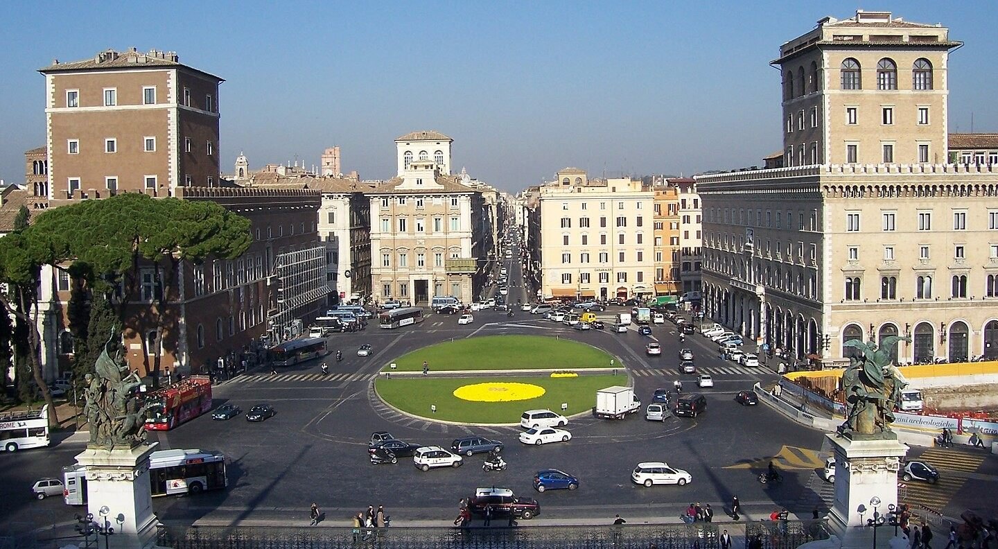
Getting Around by Car
Getting around Rome by car can be convenient for arrivals, departures, or travel to peripheral areas, but it requires attention, especially due to the presence of Limited Traffic Zones (ZTL), numerous pedestrian areas, and heavy traffic during peak hours.
Limited Traffic Zones (ZTL)
Rome’s historic center is regulated by several ZTLs active during specific time slots, with access restricted to residents and authorized vehicles. Electronic gates automatically monitor entrances, and fines are common. Before entering the city center, it is essential to check schedules, activation days, and the type of ZTL in force.
Pedestrian areas and historic center
Many central areas, such as those around Piazza di Spagna, Trevi Fountain, the Pantheon, and the Imperial Forums, are fully pedestrian or have very limited access. In these cases, it is advisable to park outside the center and continue on foot or by public transport.
Traffic and peak hours
Traffic in Rome is particularly heavy on weekdays, especially in the morning and late afternoon. Major consular roads and the ring road (GRA) can experience significant delays. Planning travel outside peak hours helps reduce stress and travel time.
Parking and stopping
Rome offers on-street parking, paid parking areas, and numerous multi-storey car parks, often located near the city center or metro stations. Blue lines indicate paid parking, while white lines are free of charge. Park-and-ride facilities near metro stops are a practical solution for leaving your car and continuing by public transport.
When it makes sense to use a car
Using a car is recommended mainly for reaching peripheral areas, zones not served by the metro, traveling with luggage, or taking trips outside the city. For moving around the historic center, public transport and walking are often the most effective choices.
🅿️ The box below shows our selection of strategically located parking areas, chosen for their proximity to the starting points of our guided itineraries. This allows you to leave your car in central areas or well connected by public transport, ideal for making the most of your visit.
✅ For more options and online bookings, you can check the ParkingMyCar service, which allows you to find parking throughout the city.
FAQ
What is the best way to get around Rome?
The most effective way is to combine different modes of transportation: walk in the historic center, use the metro, buses, and trams for longer distances, and limit car use to when it’s necessary.
Is Rome difficult to navigate for first-time visitors?It may seem complex at first, but once you understand the layout of neighborhoods and main transport options, getting around becomes easy and efficient.
📌 Learn more in the section Overview.
How can I reach central Rome from the airport?
From Fiumicino or Ciampino airports, you can reach the center via direct trains, shuttle buses, taxis, private transfers, or rental cars.
Is Rome’s main train station well connected to the city?Yes, Roma Termini is the main rail and metro hub, with efficient connections to the city center and major tourist destinations.
Is the port of Civitavecchia easily accessible from Rome?Yes, there are direct rail and road links, as well as private shuttle services from main city points.
📌 Learn more in the section Getting There.
What are the fastest public transport options in Rome?
The metro, trams, and rapid buses are the quickest for covering longer distances, while walking is ideal in the historic center.
Do buses and trams run reliably in Rome?They cover many areas, but can experience delays due to traffic, especially during peak hours.
Are there integrated tickets for multiple transport modes?Yes, the fare system offers tickets valid on metro, buses, and trams, with daily and multi-day options.
📌 Learn more in the section Public Transport.
Is it worth using a car in Rome?
Only in certain situations. Heavy traffic, ZTL zones, and pedestrian areas often make driving inconvenient in the historic center.
Where is the best place to park?In selected public or private parking lots, preferably near the starting points of our itineraries or in areas well connected by public transport.
How can I avoid fines and penalties?By checking ZTL zones, pedestrian areas, and permitted access times in advance.
📌 Learn more in the section Getting Around by Car.